Groppo
Volcanic field · Ethiopia · 852m
- Type
- Volcanic field
- Country
- Ethiopia
- Region
- Eastern Africa / Afar Rift Volcanic Province
- Elevation
- 852m
- Coordinates
- 11.816, 40.242
- Last eruption
- Unknown
- Tectonic setting
- Rift zone / Intermediate crust (15-25 km)
- Landform
- Cluster
Geological summary
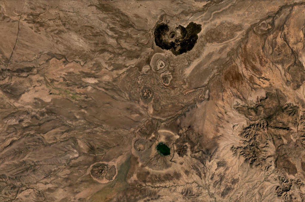
Groppo was identified by IAVCEI (1973) as a small alkali rhyolitic stratovolcano located in the western Afar near the Ethiopian escarpment, NE of Dessye. However, the nearest volcanic feature, identified in satellite imagery about 15 km NW from the given location, is a dark lava-flow field about 2.5 x 4.5 km in size, surrounding two small cones; two other smaller breached cones are nearby. The largest cone is about 300 x 500 m long, and 45 m high.
Eruption history
Detailed timeline
No eruption records available.
External links
- Not yet on Wikipedia (English). You can contribute on Wikidata.
- 🔗 Smithsonian GVP source page
⚠ For reference only. Not for emergency response.