Bilate River Field
Volcanic field · Ethiopia · 1700m
- Type
- Volcanic field
- Country
- Ethiopia
- Region
- Eastern Africa / Main Ethiopian Rift Volcanic Province
- Elevation
- 1700m
- Coordinates
- 7.070, 38.100
- Last eruption
- Unknown
- Tectonic setting
- Intraplate / Continental crust (> 25 km)
- Landform
- Cluster
- Major rock type
- No Data (checked)
Geological summary
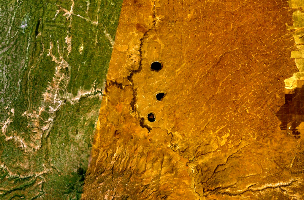
The Bilate River basin west of Lake Awasa contains a group of lake-filled maars and tuff rings of Pleistocene and probable Holocene age (WoldeGabriel 1987, pers. comm.). Active hot springs and fumaroles are located in this area.
Eruption history
Detailed timeline
No eruption records available.
External links
- Not yet on Wikipedia (English). You can contribute on Wikidata.
- 🔗 Smithsonian GVP source page
⚠ For reference only. Not for emergency response.