Mount Silali
Silali
Shield volcano · Kenya · 1528m
- Type
- Shield volcano
- Country
- Kenya
- Region
- Eastern Africa / Kenyan Rift Volcanic Province
- Elevation
- 1528m
- Coordinates
- 1.150, 36.230
- Last eruption
- -5050
- Tectonic setting
- Rift zone / Continental crust (> 25 km)
- Landform
- Shield
- Major rock type
- Trachyte / Trachydacite
Geological summary
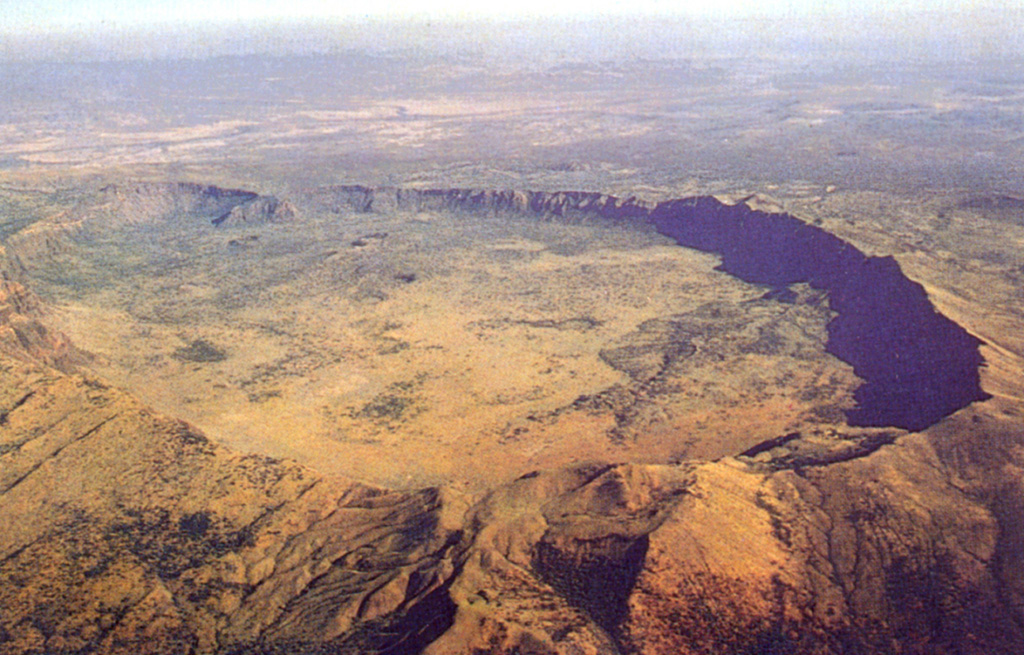
The 30-km-wide Silali trachytic shield volcano, the largest Quaternary volcano in the northern Gregory Rift, completely straddles the East African Rift. The 5 x 8 km summit caldera with 300 m deep walls is thought to have formed incrementally about 63,000 years ago, related to eruption of the Kantenmening basaltic and trachytic lava flows. A series of summit-area lava benches formed by eruptions from circumferential fissures is morphologically similar to Galapagos Islands volcanoes. The N, E, and S flanks are cut by a prominent broad rift zone 10 km wide and 30 km long, with numerous pyroclastic cones. Lava domes on the upper E flank formed during the late Pleistocene and early Holocene, until about 7,000 years ago. Youthful cones are common on the caldera floor and on the N and NE flanks; the youngest lava flows may be little more than a few hundred years old (Williams et al. 1984). Geothermal activity occurs within the caldera and on the upper E flanks.
From Wikipedia
Mount Silali is a dormant volcano in the Gregory Rift Valley, near Kapedo, Kenya. Silali is south of the Suguta Valley, which reaches northward to Lake Turkana, and is about 70 kilometres (43 mi) north of Lake Baringo.
Wikipedia · CC BY-SA · Read full article →
Eruption history
Detailed timeline
- 5050 BCE (±2000 yrs)VEI ?Geological estimateBCE 5050 – OngoingUpper east flank
- 6050 BCE (±3000 yrs)VEI ?Geological estimateBCE 6050 – OngoingEastern part of caldera
- 7050 BCE (±2000 yrs)VEI ?Geological estimateBCE 7050 – OngoingUpper east flank
External links
⚠ For reference only. Not for emergency response.