
Haylan, Jabal

Volcanic field · Yemen · 1550m

The Jabal Haylan volcanic field comprises scoria cones and tuff rings and associated lava flows across a 75-km-long area, with a portion of the field shown in this Planet Labs satellite image monthly mosaic (N is at the top; this image is approximately 52 km across). The chain crosses a NW-SE-trending fault that with visible offset in this image. Many of the cones and rings have experienced flank collapse, rafting, or erosion, leaving amphitheater-shaped craters. Some tuff rings appear to have lava domes that have formed within the crater.
The Jabal Haylan volcanic field comprises scoria cones and tuff rings and associated lava flows across a 75-km-long area, with a portion of the field shown in this Planet Labs satellite image monthly mosaic (N is at the top; this image is approximately 52 km across). The chain crosses a NW-SE-trending fault that with visible offset in this image. Many of the cones and rings have experienced flank collapse, rafting, or erosion, leaving amphitheater-shaped craters. Some tuff rings appear to have lava domes that have formed within the crater. · Photo: Satellite image courtesy of Planet Labs Inc., 2019 (https://www.planet.com/).
Type
Volcanic field
Country
Yemen
Region
Arabia-Central Asia Volcanic Regions / Southwest Arabia Volcanic Province
Elevation
1550m
Coordinates
15.400, 45.100
Last eruption
-1200
Tectonic setting
Intraplate / Continental crust (> 25 km)
Landform
Cluster
Major rock type
Basalt / Picro-Basalt
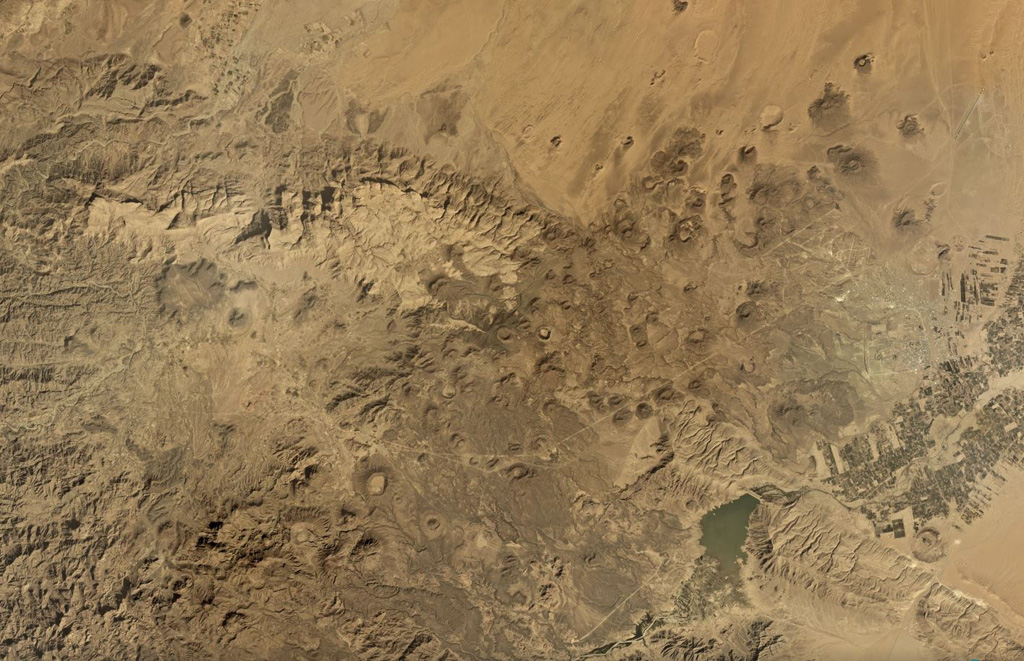
Geological summary

The Jabal Haylan area contains a 75-km-long chain of tuff cones and associated olivine basaltic lava flows in eastern Yemen. The chain crosses a NW-SE-trending fault extending between the highlands and desert lowlands to the east. One of the lava flows covers alluvial terraces that accumulated behind man-made dams from about 800-1200 BCE (Catalog of Active Volcanoes of the World).

Eruption history

Summary (VEI over time)
Click a bar to see individual eruptions
1200 BCE~1200 BCE · 1 eruptions · max VEI 01200 BCE1200 BCE1199 BCE1199 BCE1199 BCE

Detailed timeline

  1. 1200 BCEVEI 0Geological estimate
    BCE 1200 – Ongoing
    West of Sirwan

External links

⚠ For reference only. Not for emergency response.