Rumble V Seamount
Rumble V
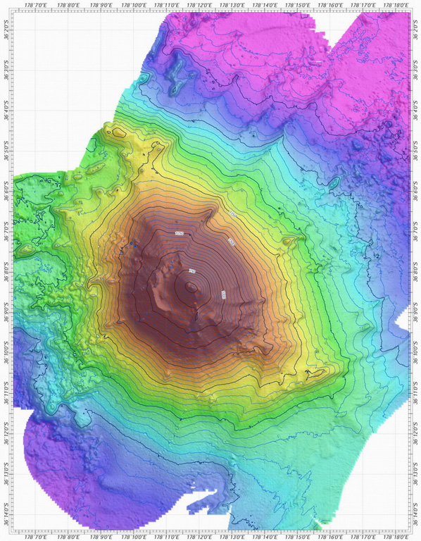
Stratovolcano · New Zealand · 400m (submarine)
- Type
- Stratovolcano
- Country
- New Zealand
- Region
- Tonga & Kermadec / Southern Kermadec Volcanic Arc
- Elevation
- 400m (submarine)
- Coordinates
- -36.142, 178.196
- Last eruption
- Unknown
- Tectonic setting
- Subduction zone / Oceanic crust (< 15 km)
- Landform
- Composite
- Major rock type
- Andesite / Basaltic Andesite
Geological summary
Rumble V was discovered in 1992 at the southernmost end of the Rumble seamounts on the southern Kermadec Ridge, 17 km ESE of Rumble IV. Andesitic and basaltic andesite rocks have been dredged from this volcano, which rises more than 2,000 m to nearly 400 m below the ocean surface and shows a pristine morphology. A large plume of gas bubbles was acoustically detected rising from the summit in 1992, and subsequent expeditions detected evidence of vigorous hydrothermal activity.
Eruption history
Detailed timeline
No eruption records available.
External links
- Not yet on Wikipedia (English). You can contribute on Wikidata.
- 🔗 Smithsonian GVP source page
⚠ For reference only. Not for emergency response.