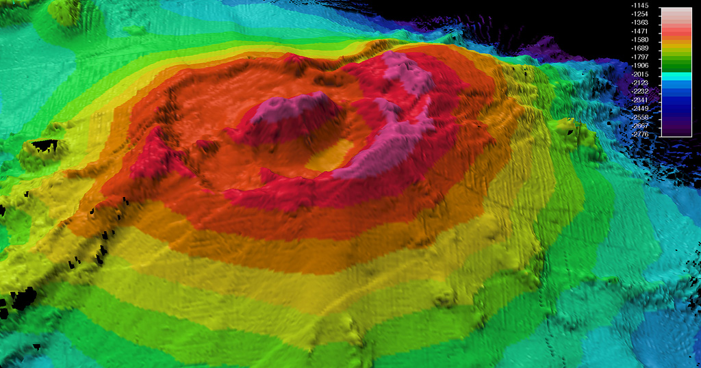
Rumble II West Seamount
Rumble II West
Stratovolcano · New Zealand · 1200m (submarine)
- Type
- Stratovolcano
- Country
- New Zealand
- Region
- Tonga & Kermadec / Southern Kermadec Volcanic Arc
- Elevation
- 1200m (submarine)
- Coordinates
- -35.353, 178.527
- Last eruption
- Unknown
- Tectonic setting
- Subduction zone / Oceanic crust (< 15 km)
- Landform
- Composite
- Major rock type
- Andesite / Basaltic Andesite
Geological summary
Rumble II West, about 12 km NW of Rumble II East, rises 1,800 m from the ocean floor to within 1,200 m of the surface. Bathymetry shows a 2.5-3 km summit caldera about 200 m deep with a central cone. There is evidence of hydrothermal activity, and cones are present on the flanks. Some lava flows on the western flanks originating from near the caldera rim have little or no sediment cover.
Eruption history
Detailed timeline
No eruption records available.
External links
- Not yet on Wikipedia (English). You can contribute on Wikidata.
- 🔗 Smithsonian GVP source page
⚠ For reference only. Not for emergency response.