Wai Sano
Sano, Wai
Caldera · Indonesia · 1319m
- Type
- Caldera
- Country
- Indonesia
- Region
- Sunda & Banda / Sunda Volcanic Arc
- Elevation
- 1319m
- Coordinates
- -8.735, 120.007
- Last eruption
- Unknown
- Tectonic setting
- Subduction zone / Continental crust (> 25 km)
- Landform
- Composite
- Major rock type
- Dacite
Geological summary
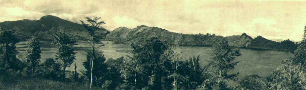
The Wai Sano composite volcano at the western end of Flores Island includes a 2.5 x 3.5 km elliptical caldera in the NW part of a larger 9-10 km edifice. The caldera contains Sanonggoang Lake, with a surface more than 200 m below the high point on the southern caldera rim. The Poco Sesok and Poco Dedeng peaks are near the center of the eroded massif. The area has been a target of geothermal investigations, and two solfataras are located at the SE shore of the lake. No eruptions have been reported or dated, but the area was mapped as Holocene (Ratman and Yasin, 1978).
Eruption history
Detailed timeline
No eruption records available.
External links
⚠ For reference only. Not for emergency response.