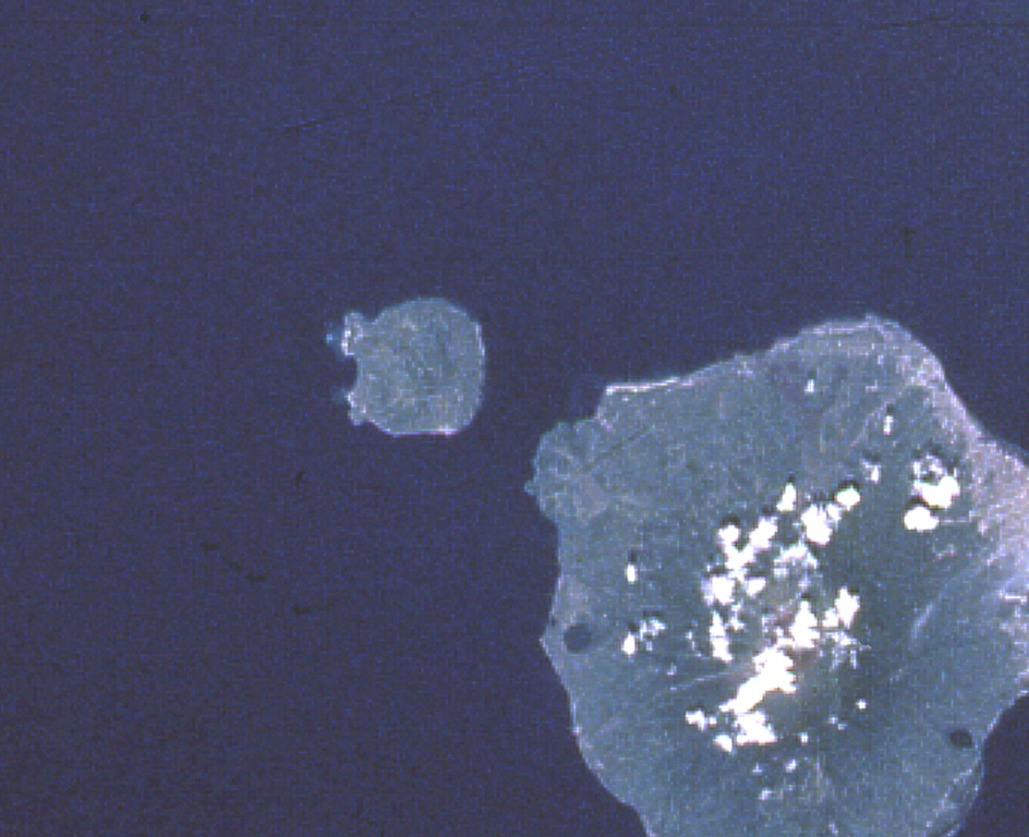
Mount Hiri

Hiri

Stratovolcano · Indonesia · 687m

Hiri (left-center), a small 3-km-wide forested island immediately north of Ternate Island (lower right), is the northernmost of a chain of volcanic islands off the western coast of Halmahera.  North is to the upper left in this Space Shuttle image.  Little is known of this volcano, although it was mapped as Holocene in age.  In contrast to Hiri, the better-known Gamalama volcano that forms Ternate Island has been active during historical time, including a 1775 eruption from the small lake-filled maar visible on the NW coast of the island.
Hiri (left-center), a small 3-km-wide forested island immediately north of Ternate Island (lower right), is the northernmost of a chain of volcanic islands off the western coast of Halmahera. North is to the upper left in this Space Shuttle image. Little is known of this volcano, although it was mapped as Holocene in age. In contrast to Hiri, the better-known Gamalama volcano that forms Ternate Island has been active during historical time, including a 1775 eruption from the small lake-filled maar visible on the NW coast of the island. · Photo: NASA Space Shuttle image STS050-99-95, 1992 (http://eol.jsc.nasa.gov/).
Type
Stratovolcano
Country
Indonesia
Region
Western Pacific Volcanic Regions / Halmahera Volcanic Arc
Elevation
687m
Coordinates
0.897, 127.317
Last eruption
Unknown
Tectonic setting
Subduction zone / Oceanic crust (< 15 km)
Landform
Composite
Major rock type
Basalt / Picro-Basalt
Geological summary

Hiri is a 3-km-wide forested island immediately north of Gamalama on Ternate Island, and is the northernmost of a chain of volcanic islands off the western coast of Halmahera. Two conical volcanic edifices are present within a larger caldera open to the W. Apandi and Sudana (1980) mapped it as Holocene in age, but no eruptions have been dated or reported.

From Wikipedia

Hiri is a small, 3-kilometre-wide forested island immediately north of the island of Ternate, in the Maluku Islands of Indonesia. It is located at the northernmost part of a chain of volcanic islands off the western coast of Halmahera. It is a conical stratovolcano which rises to 630 m (2,067 ft). The island covers 9.72 km2 and had a population of 2,880 in mid 2023; it is administered as a district (kecamatan) of the City of Ternate. Its dominant neighbour to the south is the more active volcano of Mount Gamalama, on Ternate island.

Wikipedia · CC BY-SA · Read full article

Eruption history

Detailed timeline

No eruption records available.

External links

⚠ For reference only. Not for emergency response.