Camiguin de Babuyanes
Stratovolcano · Philippines · 712m
- Type
- Stratovolcano
- Country
- Philippines
- Region
- Western Pacific / Luzon Volcanic Arc
- Elevation
- 712m
- Coordinates
- 18.830, 121.860
- Last eruption
- 1857
- Tectonic setting
- Subduction zone / Crustal thickness unknown
- Landform
- Composite
- Major rock type
- Andesite / Basaltic Andesite
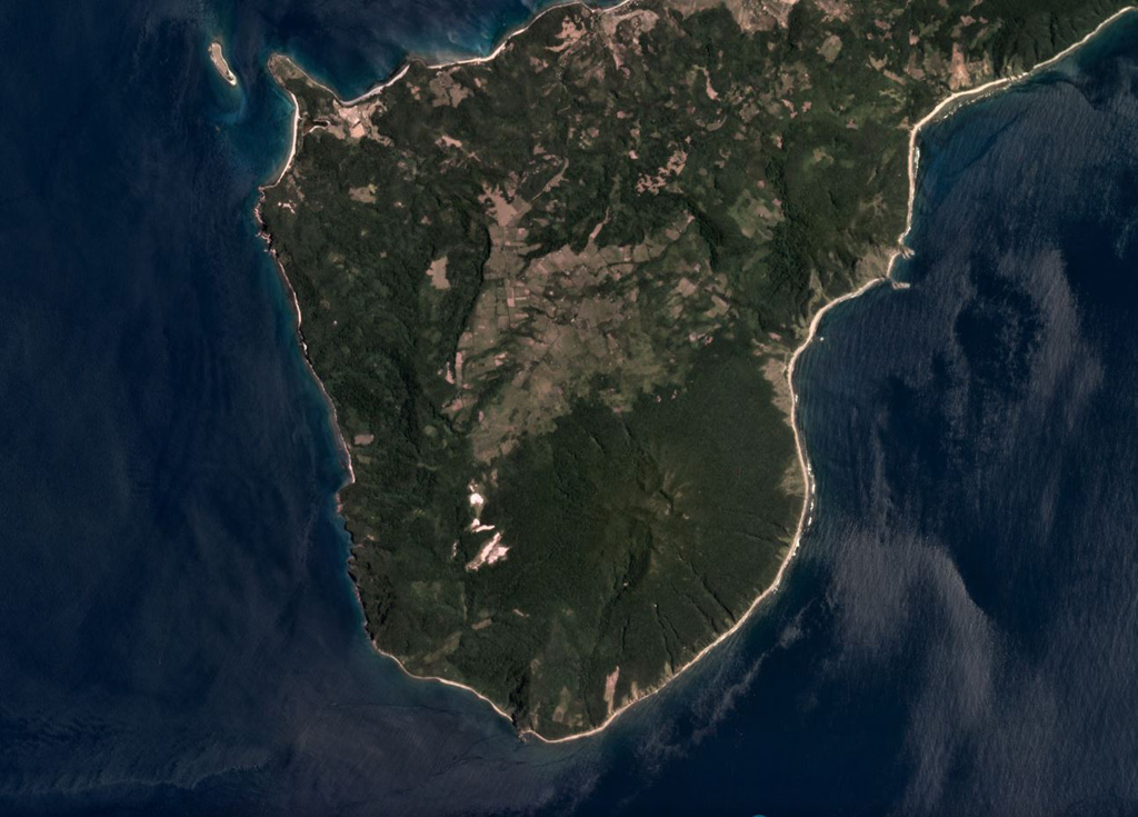
Geological summary
Forested Mount Camiguin occupies the SW tip of 22-km-long Camiguin Island in the Babuyan archipelago, north of Luzon Island. Following construction of an andesitic volcano during the Pliocene, the subsidiary cones of Minabul to the north and Caanoan to the east were constructed on the northern part of the island. The southern part of the island consists of three volcanic centers located along a SSE-NNW line, the andesitic Mount Camiguin stratovolcano and the young andesitic lava domes of Mt. Malabsing and Pamoctan. A phreatic eruption, possibly in part submarine, was reported from Camiguin de Babuyanes around 1857. Fumaroles are found on the SW, W, and E flanks of the volcano, and a boiling spring is located near sea level on the W flank.
Eruption history
Detailed timeline
- 1857VEI 2Observed1857-07-02 – OngoingSW flank
External links
⚠ For reference only. Not for emergency response.