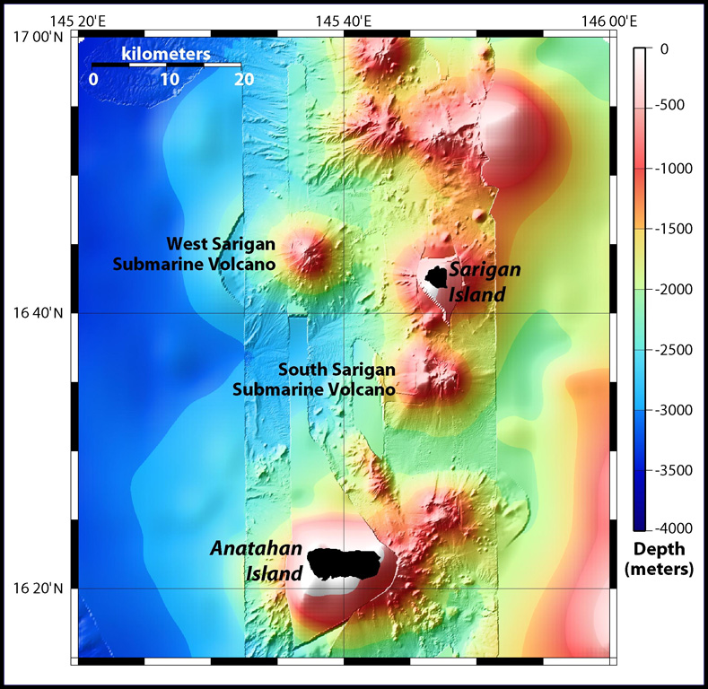
South Sarigan Seamount
Stratovolcano · United States · 184m (submarine)
- Type
- Stratovolcano
- Country
- United States
- Region
- Northwestern Pacific / Mariana Volcanic Arc
- Elevation
- 184m (submarine)
- Coordinates
- 16.580, 145.780
- Last eruption
- 2010
- Tectonic setting
- Subduction zone / Crustal thickness unknown
- Landform
- Composite
- Major rock type
- No Data (checked)
Geological summary
South Sarigan seamount, rising to within about 184 m of the ocean surface 12 km S of Sarigan Island, was the site of a short explosive submarine eruption in May 2010 that produced a plume of ash and steam to 12 km altitude. Sidescan sonar imagery taken in 2003 shows an irregular summit with multiple peaks, including a possibly young cone at about 350 m depth, and flank morphology suggests it is a frequently active volcano.
Eruption history
Summary (VEI over time)
Click a bar to see individual eruptions
Detailed timeline
- 2010VEI 3Observed2010-05-27 – 2010-05-29Northern summit cone, 184 m below sea level
External links
- Not yet on Wikipedia (English). You can contribute on Wikidata.
- 🔗 Smithsonian GVP source page
⚠ For reference only. Not for emergency response.