Kinenin
Maar · Russia · 583m
- Type
- Maar
- Country
- Russia
- Region
- Northwestern Pacific / Central Kamchatka Volcanic Arc
- Elevation
- 583m
- Coordinates
- 57.350, 160.970
- Last eruption
- 850
- Tectonic setting
- Subduction zone / Continental crust (> 25 km)
- Landform
- Minor
- Major rock type
- Basalt / Picro-Basalt
Geological summary
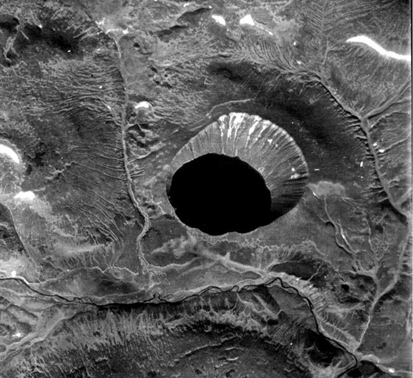
Kinenin maar lies at the eastern foot of the Sredinny Range, about 80 km NNW of Sheveluch volcano. The 2.5-km-wide, funnel-shaped maar was formed along the Kinenin River, a tributary of the Elovka. It is partially filled by a 1-km-wide lake whose surface is at 400 m elevation. The eastern rim at about 580 m is the high point of the crater. The eruption of Kinenin took place about 1,100 years ago, making it the youngest known maar in Kamchatka. Both silicic pyroclastic flows and mafic pyroclastic ejecta were produced, which were distributed primarily to the ENE. The location is north of the active Kamchatka subduction zone.
Eruption history
Summary (VEI over time)
Click a bar to see individual eruptions
Detailed timeline
- 850 (±50 yrs)VEI 4Geological estimate850 – Ongoing
External links
- Not yet on Wikipedia (English). You can contribute on Wikidata.
- 🔗 Smithsonian GVP source page
⚠ For reference only. Not for emergency response.