CoAxial Segment
Fissure vent · Undersea Features · 2400m (submarine)
- Type
- Fissure vent
- Country
- Undersea Features
- Region
- Eastern Pacific / Northeast Pacific Rifts Volcanic Province
- Elevation
- 2400m (submarine)
- Coordinates
- 46.520, -129.580
- Last eruption
- 1993
- Tectonic setting
- Rift zone / Oceanic crust (< 15 km)
- Landform
- Cluster
- Major rock type
- Basalt / Picro-Basalt
Geological summary
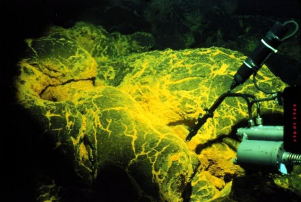
The CoAxial segment of the Juan de Fuca Ridge is about 435 km W of the Oregon coast, NE of Axial volcano. A submarine eruption along the CoAxial segment that produced thermal plumes and a new lava flow was detected by acoustic hydrophones in June 1993, just days after installation of the hydrophone system. This was the first deep-sea volcanic eruption detected as it was happening. The location of the eruption was at a depth of about 2,400 m, about 37 km NE of Axial volcano. Bathymetric surveys indicated that one or more additional sea-floor lava extrusions took place immediately east of the 1993 lava flow sometime between 1981-82 and 1991.
Eruption history
Summary (VEI over time)
Click a bar to see individual eruptions
Detailed timeline
- 1993VEI 0Observed1993-06-26 – 1993-07-04N end CoAxial segment, Juan de Fuca Ridge
- 1986 (±5 yrs)VEI 0Observed1986-07-02 – OngoingCoAxial segment, Juan de Fuca Ridge
External links
- Not yet on Wikipedia (English). You can contribute on Wikidata.
- 🔗 Smithsonian GVP source page
⚠ For reference only. Not for emergency response.