Chacana
Caldera · Ecuador · 4643m
- Type
- Caldera
- Country
- Ecuador
- Region
- South America / Northern Andean Volcanic Arc
- Elevation
- 4643m
- Coordinates
- -0.375, -78.250
- Last eruption
- 1773
- Tectonic setting
- Subduction zone / Continental crust (> 25 km)
- Landform
- Caldera
- Major rock type
- Rhyolite
Geological summary
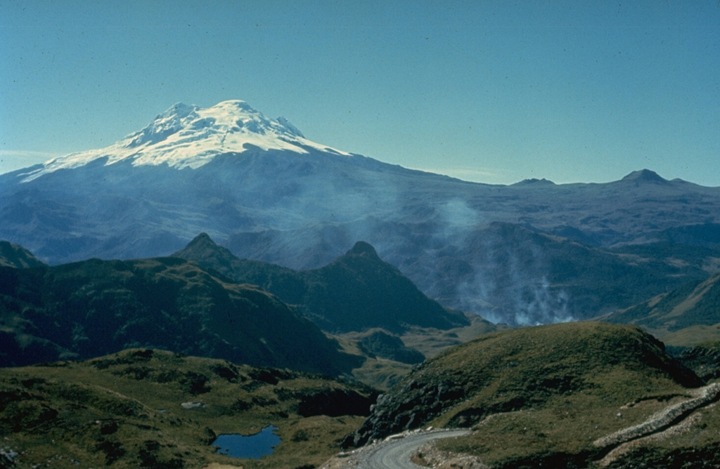
Chacana is a massive, eroded caldera complex of Pliocene-Holocene age that forms one of the largest rhyolitic centers of the northern Andes. The caldera is 32 km long in the N-S direction and 18-24 km wide E-W. It was constructed during three cycles of andesitic-to-rhyolitic volcanism, with major eruptions about 240,000, 180,00, and 160,000 years ago. Dacitic lava flows were erupted from caldera-floor fissures between about 30,000 and 21,000 years ago. Numerous lava domes were constructed within the caldera, which has been the source of frequent explosive eruptions throughout the Holocene as well as historical lava flows during the 18th century. The massive Antisana stratovolcano was constructed immediately to the SE.
From Wikipedia
Chacana is a large 32-km long - 18–24 km wide caldera that has erupted in historical times. It forms one of the largest rhyolite centers in the Northern Andes with major eruptions over the past 240,000, 180,00, and 160,000 years ago and has had andesitic-rhyolitic volcanism. With dacitic lava flows continuing into historical times. Lava domes were also constructed in the Holocene. Chacana is located 30 km from Quito and the large Antisana volcano is constructed to the southeast.
Wikipedia · CC BY-SA · Read full article →
Eruption history
Detailed timeline
- 1773VEI 0Observed1773 – OngoingSouth part of caldera
- 1760VEI 0Observed1760 – OngoingSW flank
- 50 BCEVEI ?Geological estimateBCE 50 – Ongoing
- 1580 BCE (±10 yrs)VEI ?Geological estimateBCE 1580 – Ongoing
- 8050 BCEVEI ?Geological estimateBCE 8050 – Ongoing
External links
⚠ For reference only. Not for emergency response.