Cayutue-La Vigueria
Volcanic field · Chile · 506m
- Type
- Volcanic field
- Country
- Chile
- Region
- South America / Southern Andean Volcanic Arc
- Elevation
- 506m
- Coordinates
- -41.300, -72.270
- Last eruption
- -190
- Tectonic setting
- Subduction zone / Continental crust (> 25 km)
- Landform
- Cluster
- Major rock type
- Basalt / Picro-Basalt
Geological summary
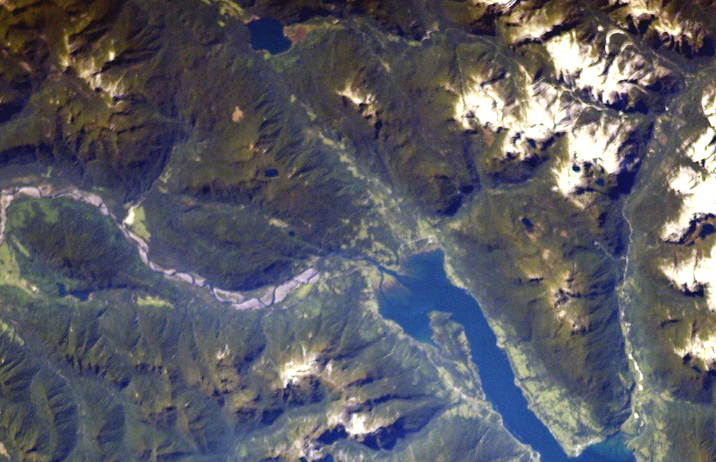
The Cayutué-La Viguería volcanic field consists of about 20 basaltic maars and cinder cones of Holocene age along the N-S-trending Liquiñe-Ofqui fault zone. The field occupies a low-lying area between the southern end of Ensenada Cayutué (the southern extension of Lake Todos los Santos) and the northern end of the Estuario Reloncaví. La Viguería and Volcán Cayutué are the principal cones. Formation of La Viguería and associated lava flows temporarily dammed the Río Petrohué about 3,000 years ago, forming an ephemeral lake that was filled with deposits from Calbuco and Osorno volcanoes. Pyroclastic cones and lava flows filled the Ensenada de Cayutué depression, separating Lake Todos los Santos from Ralún Bay.
Eruption history
Detailed timeline
- 190 BCE (±190 yrs)VEI ?Geological estimateBCE 190 – OngoingLa Viguería
External links
- Not yet on Wikipedia (English). You can contribute on Wikidata.
- 🔗 Smithsonian GVP source page
⚠ For reference only. Not for emergency response.