Brennisteinsfjöll
Brennisteinsfjoll
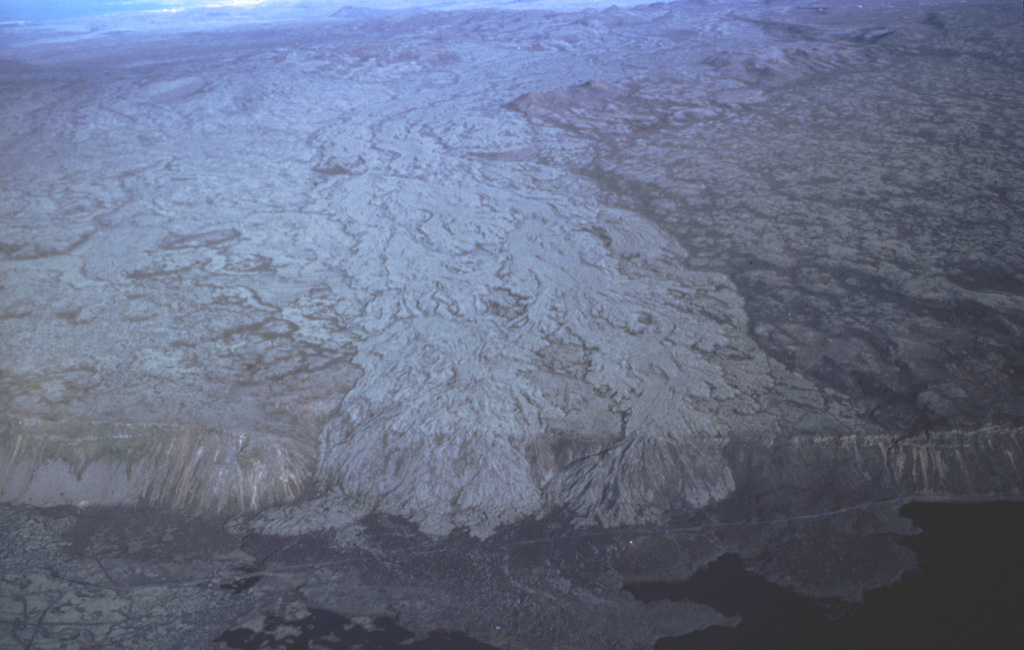
Crater rows · Iceland · 610m
- Type
- Crater rows
- Country
- Iceland
- Region
- Atlantic Ocean / Iceland Neovolcanic Rift Volcanic Province
- Elevation
- 610m
- Coordinates
- 63.933, -21.783
- Last eruption
- 1341
- Tectonic setting
- Rift zone / Oceanic crust (< 15 km)
- Landform
- Cluster
- Major rock type
- Basalt / Picro-Basalt
Geological summary
The Brennisteinsfjöll volcanic system, located east of Kleifarvatn lake, consists of a series of NE-SW-trending crater rows and small shield volcanoes. Postglacial and historical basaltic lavas cover a wide area. An eruption in 1000 CE was dated by its occurrence at the time of a meeting of the Icelandic outdoor parliament at Thingvellier. The most recent eruption took place in the 14th century.
From Wikipedia
Brennisteinsfjöll is a minor volcanic system, with crater rows and small shield volcanoes on the Reykjanes Peninsula in southwest Iceland.
Wikipedia · CC BY-SA · Read full article →
Eruption history
Summary (VEI over time)
Click a bar to see individual eruptions
Detailed timeline
- 1341 (±1 yrs)VEI 2Observed1341 – OngoingGrafeldur (Selvogshraun)
- 1200VEI 2Geological estimate1200 – OngoingKongsfell
- 1000VEI 0Observed1000-06-25 – OngoingEldborg at Lambafell
- 950VEI 2Geological estimate950 – OngoingRjupnadyngjur
- 910 (±75 yrs)VEI 2Geological estimate910 – OngoingKista (Breiddalshraun)
- 875 (±50 yrs)VEI 2Geological estimate875 – OngoingTvibollar
- 1040 BCE (±75 yrs)VEI 2Geological estimateBCE 1040 – OngoingEldborg at Brennisteinsfjöllum
- 2660 BCE (±75 yrs)VEI 0Geological estimateBCE 2660 – OngoingLeitin
- 9000 BCEVEI 0Geological estimateBCE 9000 – OngoingHeidin Há
External links
⚠ For reference only. Not for emergency response.