Þeistareykjarbunga
Theistareykir
Shield volcano · Iceland · 563m
- Type
- Shield volcano
- Country
- Iceland
- Region
- Atlantic Ocean / Iceland Neovolcanic Rift Volcanic Province
- Elevation
- 563m
- Coordinates
- 65.883, -16.967
- Last eruption
- -900
- Tectonic setting
- Rift zone / Oceanic crust (< 15 km)
- Landform
- Shield
- Major rock type
- Basalt / Picro-Basalt
Geological summary
The Holocene Theistareykir fissure system, including the basaltic Theistareykjarbunga shield volcano, extends from north of Myvatn lake to the coast of Iceland. This is the northernmost subaerial volcanic system along the Eastern Volcanic Zone of Iceland. The 30 km3 Theistareykjarbunga shield volcano formed slightly after deglaciation; the youngest dated eruption produced the Theistareykjahraun lava flow about 2,400 years ago.
From Wikipedia
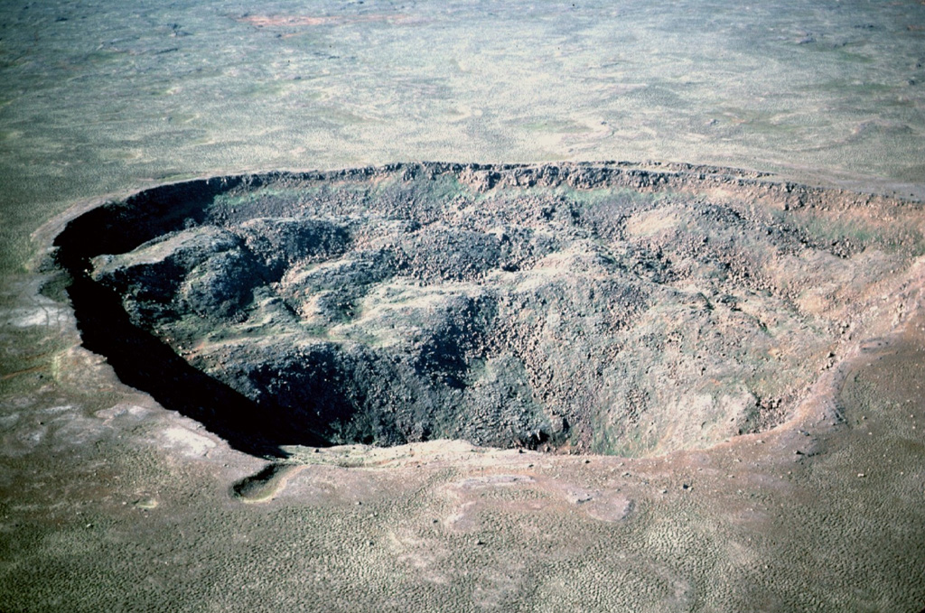
Theistareykjarbunga is a shield volcano in north-eastern Iceland with two fissure vents called Þeistareykjahraun and Borgahraun, and two cones: the 370 m (1,210 ft) Stórahversmór and the 540 m (1,770 ft), 30 km3 (7.2 cu mi) Stóravíti. They both are currently extinct, although there is evidence suggesting the potential for activity such as recent localised uplift and seismicity. The multiple vents make up the Theistareykir (Þeistareykir) volcanic system, with more recent evidence that the former classification as a shield volcano is better considered an embryonic central volcano with associated fissure swarm, as rhyolite has erupted in a limited area. The recent lava has picrite, olivine tholeiite basalt characteristics but before the ice age there were basaltic andesite and rhyolite eruptions. There is a central high temperature geothermal area with numerous steam vents and fumaroles. This has been utilised by a 90 MWe power station.
Wikipedia · CC BY-SA · Read full article →
Eruption history
Detailed timeline
- 900 BCE (±100 yrs)VEI 0Geological estimateBCE 900 – OngoingStorihver (Theistareykjahraun)
- 6800 BCEVEI 0Geological estimateBCE 6800 – OngoingBorgarhraun and other flows
- 9500 BCEVEI 0Geological estimateBCE 9500 – OngoingTheistareykjabunga shield volcano
External links
⚠ For reference only. Not for emergency response.