Buckle Island
Stratovolcano · Antarctica · 1239m
- Type
- Stratovolcano
- Country
- Antarctica
- Region
- Antarctic & Scotia / Balleny Hotspot Volcano Group
- Elevation
- 1239m
- Coordinates
- -66.780, 163.250
- Last eruption
- 1899
- Tectonic setting
- Rift zone / Oceanic crust (< 15 km)
- Landform
- Composite
- Major rock type
- Trachybasalt / Tephrite Basanite
Geological summary
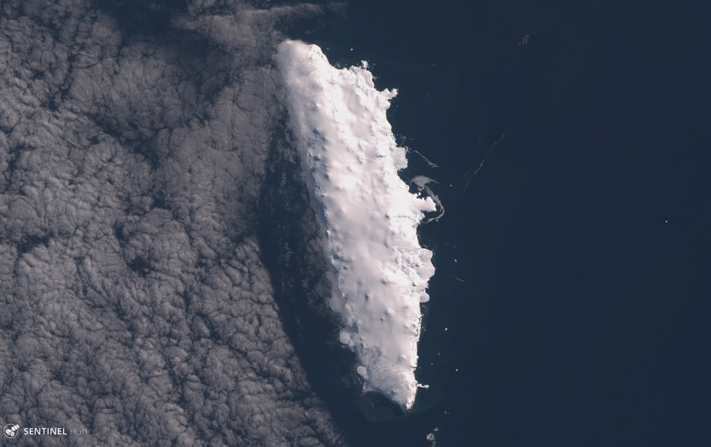
Buckle Island is in the center of a 160-km-long chain of volcanic islands forming the Balleny Islands off the coast of Antarctica's Victoria Land. The islands are located at the southern end of a submarine ridge system that extends north to New Zealand, but is offset by the Indian-Antarctic ridge system. The elongated, 21-km-long island is capped by an gently sloping icecap that descends steeply to the sea between rocky cliffs. Dark eruption columns were reported during 1839 and 1899, but no detailed geological studies exist for the Balleny Islands volcanoes.
From Wikipedia
Buckle Island is one of the three main islands in the uninhabited Balleny Islands group located in the Southern Ocean. It lies 25 km (16 mi) north-west of Sturge Island and 8 km (5 mi) south-east of Young Island, some 110 km (68 mi) north-north-east of Belousov Point on the Antarctic mainland.
Wikipedia · CC BY-SA · Read full article →
Eruption history
Detailed timeline
- 1899VEI 2Observed1899-01-12 – Ongoing
- 1839VEI 2Observed1839-02-09 – Ongoing
External links
⚠ For reference only. Not for emergency response.