Groppo
Campo volcánico · Ethiopia · 852 m
- Tipo
- Campo volcánico
- País
- Ethiopia
- Región
- África Oriental / Afar Rift Volcanic Province
- Altitud
- 852 m
- Coordenadas
- 11.816, 40.242
- Última erupción
- Desconocido
- Contexto tectónico
- Rift zone / Intermediate crust (15-25 km)
- Forma volcánica
- Cluster
Resumen geológico
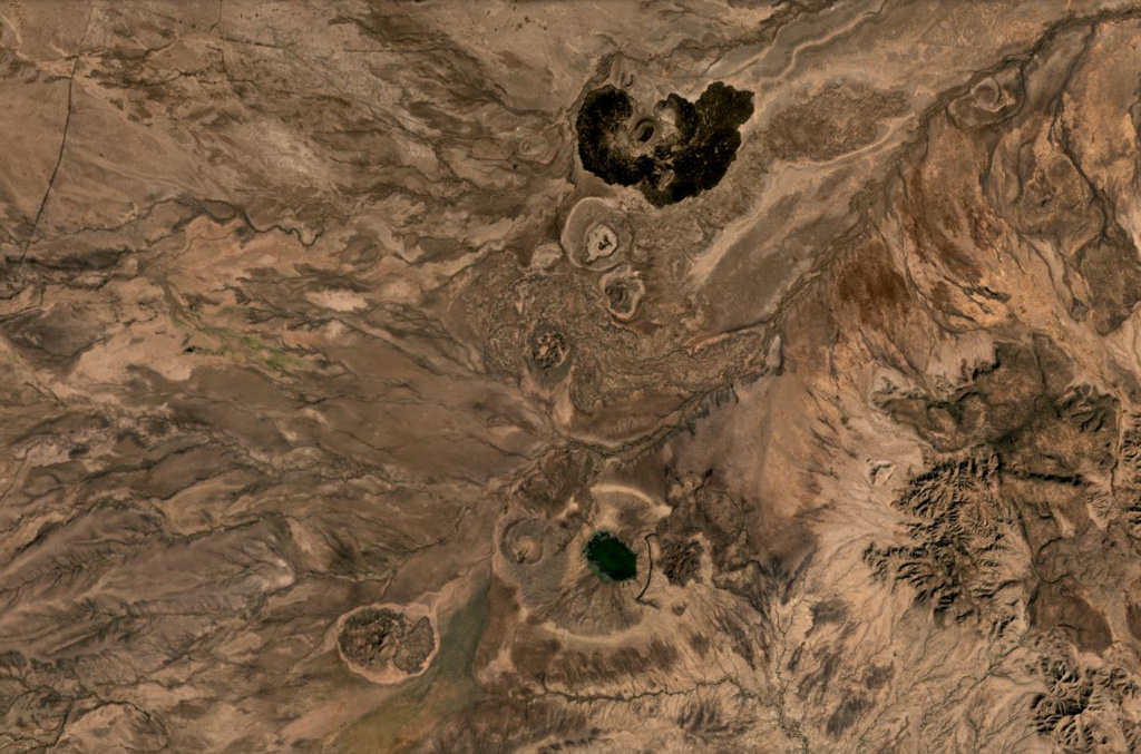
Groppo was identified by IAVCEI (1973) as a small alkali rhyolitic stratovolcano located in the western Afar near the Ethiopian escarpment, NE of Dessye. However, the nearest volcanic feature, identified in satellite imagery about 15 km NW from the given location, is a dark lava-flow field about 2.5 x 4.5 km in size, surrounding two small cones; two other smaller breached cones are nearby. The largest cone is about 300 x 500 m long, and 45 m high.
Historial de erupciones
Línea de tiempo detallada
No hay registros de erupciones disponibles.
Enlaces externos
- Todavía no está en Wikipedia (Español). Puede contribuir en Wikidata.
- 🔗 Página original del Smithsonian GVP
⚠ Solo como referencia. No apto para respuesta ante emergencias.