Bilate River Field
Campo volcánico · Ethiopia · 1700 m
- Tipo
- Campo volcánico
- País
- Ethiopia
- Región
- África Oriental / Main Ethiopian Rift Volcanic Province
- Altitud
- 1700 m
- Coordenadas
- 7.070, 38.100
- Última erupción
- Desconocido
- Contexto tectónico
- Intraplate / Continental crust (> 25 km)
- Forma volcánica
- Cluster
- Roca principal
- No Data (checked)
Resumen geológico
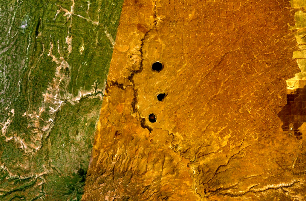
The Bilate River basin west of Lake Awasa contains a group of lake-filled maars and tuff rings of Pleistocene and probable Holocene age (WoldeGabriel 1987, pers. comm.). Active hot springs and fumaroles are located in this area.
Historial de erupciones
Línea de tiempo detallada
No hay registros de erupciones disponibles.
Enlaces externos
- Todavía no está en Wikipedia (Español). Puede contribuir en Wikidata.
- 🔗 Página original del Smithsonian GVP
⚠ Solo como referencia. No apto para respuesta ante emergencias.