North Island
Lake Turkana North Island
Cono de toba · Kenya · 490 m
- Tipo
- Cono de toba
- País
- Kenya
- Región
- África Oriental / Kenyan Rift Volcanic Province
- Altitud
- 490 m
- Coordenadas
- 4.063, 36.046
- Última erupción
- Desconocido
- Contexto tectónico
- Rift zone / Continental crust (> 25 km)
- Forma volcánica
- Minor (Basaltic)
- Roca principal
- Trachyandesite / Basaltic Trachyandesite
Resumen geológico
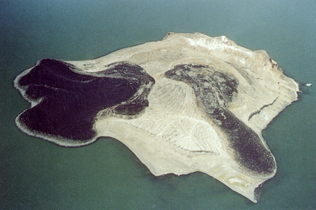
The 2-km-wide North Island in Lake Turkana is the northernmost and smallest of three volcanic islands in the lake. It is primarily composed of trachyandesitic-to-trachytic phreatomagmatic deposits from overlapping eroded tuff cones or tuff rings. The center of the island consists of a young tuff ring about 1 km in diameter nested inside an older tuff ring. Two fresh unvegetated lava flows that reach the lake shore from the central tuff ring form lava deltas on the N and W sides of the island; the northern delta is about 900 m wide. The two blocky lava flows are younger than a terrace that formed less than 10,000 years ago during the last major high-water level (Key and Watkins, 1988). Geothermal activity occurs along a curvilinear ridge on the S portion of the island and on wave-cut platforms and beaches on the SW shoreline.
Historial de erupciones
Línea de tiempo detallada
No hay registros de erupciones disponibles.
Enlaces externos
- Todavía no está en Wikipedia (Español). Puede contribuir en Wikidata.
- 🔗 Página original del Smithsonian GVP
⚠ Solo como referencia. No apto para respuesta ante emergencias.