Ol Kokwe
Volcán en escudo · Kenya · 1130 m
- Tipo
- Volcán en escudo
- País
- Kenya
- Región
- África Oriental / Kenyan Rift Volcanic Province
- Altitud
- 1130 m
- Coordenadas
- 0.620, 36.075
- Última erupción
- Desconocido
- Contexto tectónico
- Rift zone / Continental crust (> 25 km)
- Forma volcánica
- Shield
- Roca principal
- Basalt / Picro-Basalt
Resumen geológico
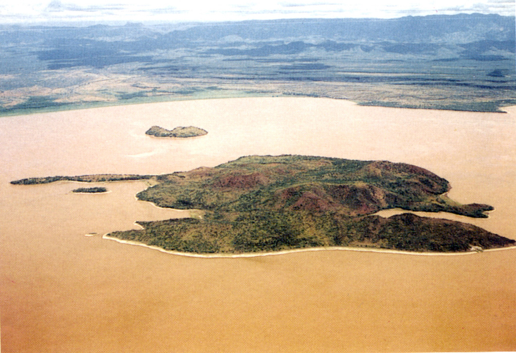
The elongated Ol Kokwe Island in the center of Lake Baringo SW of Korosi volcano consists of young basaltic scoria cones that cap a trachytic shield volcano. N-S-trending faults cut the complex, producing W-facing scarps. Smaller islands to the N and S are faulted basaltic lava flows; Parmalok Island to the SW is a breached trachytic tuff cone that fed a small lava flow. The latest eruptive activity was estimated to have occurred within the past thousand years (Smith 1991, pers. comm.). Hot springs, boiling mud pools, and fumaroles are present along the faults on the NE peninsula of the island and are frequently visited by tourists.
Historial de erupciones
Línea de tiempo detallada
No hay registros de erupciones disponibles.
Enlaces externos
- Todavía no está en Wikipedia (Español). Puede contribuir en Wikidata.
- 🔗 Página original del Smithsonian GVP
⚠ Solo como referencia. No apto para respuesta ante emergencias.