Fort Portal
Fort Portal Volcanic Field
Campo volcánico · Uganda · 1615 m
- Tipo
- Campo volcánico
- País
- Uganda
- Región
- África Oriental / Albertine Rift Volcanic Province
- Altitud
- 1615 m
- Coordenadas
- 0.700, 30.250
- Última erupción
- -2120
- Contexto tectónico
- Rift zone / Continental crust (> 25 km)
- Forma volcánica
- Cluster
- Roca principal
- Foidite
Resumen geológico
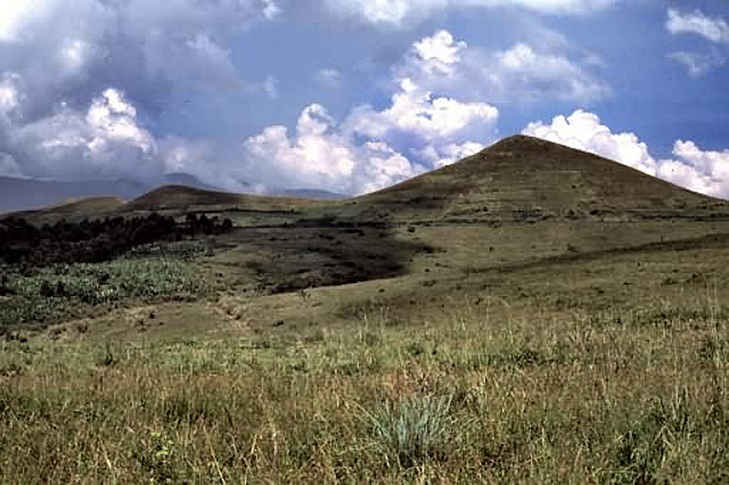
The carbonatite lavas and tuffs of the Fort Portal Volcanic Field in Uganda, NE of Mount Ruwenzori between Lake Albert and Lake Edward, consists of a group of tuff cones and maars covering an area of about 145 km2. About 50 volcanic vents, some of which now contain crater lakes, were erupted through Precambrian gneiss in an WSW-ENE-trending area north of the town of Fort Portal. Several additional vents are located in the Kasekere (Rusekere) area to the NE. Radiocarbon dates of about 4,700-4,000 years ago were obtained from ash deposits in the volcanic field. Holmes (1950) noted that Kasensankaranga Crater in the Fort Portal area means "spewer of roasted material," implying observed activity.
Historial de erupciones
Línea de tiempo detallada
- 2120 a. C. (±100 años)VEI ?Estimación geológicaBCE 2120 – En curso
- 2750 a. C. (±75 años)VEI ?Estimación geológicaBCE 2750 – En curso
Enlaces externos
- Todavía no está en Wikipedia (Español). Puede contribuir en Wikidata.
- 🔗 Página original del Smithsonian GVP
⚠ Solo como referencia. No apto para respuesta ante emergencias.