Tombel Graben
Campo volcánico · Cameroon · 500 m
- Tipo
- Campo volcánico
- País
- Cameroon
- Región
- África del Norte / Western Africa Volcanic Province
- Altitud
- 500 m
- Coordenadas
- 4.758, 9.717
- Última erupción
- Desconocido
- Contexto tectónico
- Intraplate / Continental crust (> 25 km)
- Forma volcánica
- Cluster
- Roca principal
- Trachybasalt / Tephrite Basanite
Resumen geológico
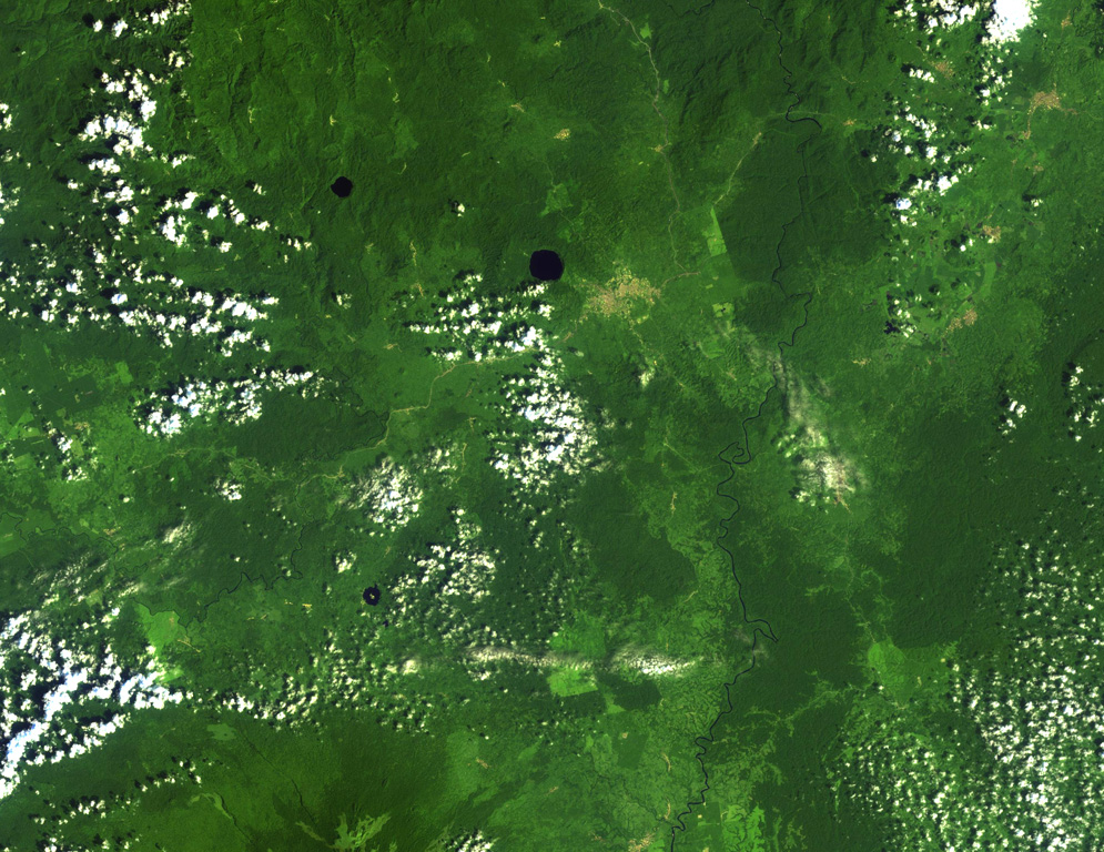
Young cinder cones and maars are abundant in the low-lying Tombel Graben (also referred to as the Tombel Plain) between Mount Cameroon and Mount Manengouba (within 4°58'N, 9°51'E and 4°33'N, 9°35'E). Mount Koupe, composed of Tertiary syenite, dominates the area. Activity began with the emission of large lava flows over Precambrian metamorphic rocks and Cretaceous sandstones, and concluded with explosive activity forming numerous cinder cones. The 800 km2 volcanic field, which erupted basanitic, basaltic, and trachybasaltic rocks, contains three large lake-filled maars, including Barombi Mbo, a compound maar near the town of Kumba. Legends record an eruption of Le Djungo (also known as Mont Pelé) that destroyed a village; though a small craterless cone is marked along a fault line on a map in Nkono (2009, after Nkouathio et al., 2002) it's unclear what cone is being described by the story, because no noticeably younger or unvegetated cones are apparent in satellite imagery. Two samples taken from the Njombe area in the farthest SW part of the field were K-Ar dated as possible Holocene (Nkouathio et al., 2008), though the error was too large to be definitive.
Historial de erupciones
Línea de tiempo detallada
No hay registros de erupciones disponibles.
Enlaces externos
- Todavía no está en Wikipedia (Español). Puede contribuir en Wikidata.
- 🔗 Página original del Smithsonian GVP
⚠ Solo como referencia. No apto para respuesta ante emergencias.