Harra of Arhab
Arhab, Harra of
Campo volcánico · Yemen · 3100 m
- Tipo
- Campo volcánico
- País
- Yemen
- Región
- Arabia y Asia Central / Southwest Arabia Volcanic Province
- Altitud
- 3100 m
- Coordenadas
- 15.602, 44.098
- Última erupción
- 500
- Contexto tectónico
- Intraplate / Continental crust (> 25 km)
- Forma volcánica
- Cluster
- Roca principal
- Trachybasalt / Tephrite Basanite
Resumen geológico
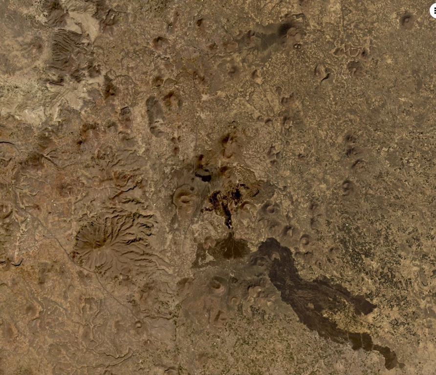
The Quaternary Harra of Arhab in Yemen, north of the capital city of Sana'a, consists of a 1,500 km2 basaltic plateau capped by a few small stratovolcanoes and about 60 scoria cones, two of which have erupted in historical time. Cones in the volcanic field (also known as the Sana'a or the Sana'a-Amran volcanic field) are commonly aligned along a NNW trend above a 100-250-m-thick volcanic plateau. Pliocene-to-Holocene volcanic rocks have a dominantly basaltic-to-hawaiitic composition and overlie the northern end of an area of extensive Oligocene-Miocene basaltic-to-rhyolitic rocks that extends to the SW tip of the Arabian Peninsula. Baker et al. (1997) include outcrops of Quaternary volcanism south of the main area of lava flows, such as Jabal al Marha, as part of this system, but note that they can be difficult to distinguish from Oligocene flood basalts. The latest eruption took place between about 400 and 600 CE and produced a lava flow that traveled 9 km.
Historial de erupciones
Línea de tiempo detallada
- 500 (±100 años)VEI 0Observado500 – En cursoSouth flank of Kaulet Hattab
- 200VEI 2Estimación geológica200 – En cursoEast flank of Jabal Zebib
Enlaces externos
⚠ Solo como referencia. No apto para respuesta ante emergencias.