Tofua Arc at 20.9°S
Estratovolcán · Tonga · 296 m (submarino)
- Tipo
- Estratovolcán
- País
- Tonga
- Región
- Tonga y Kermadec / Tofua Volcanic Arc
- Altitud
- 296 m (submarino)
- Coordenadas
- -20.852, -175.550
- Última erupción
- 2017
- Contexto tectónico
- Subduction zone / Oceanic crust (< 15 km)
- Forma volcánica
- Composite
- Roca principal
- No Data (checked)
Resumen geológico
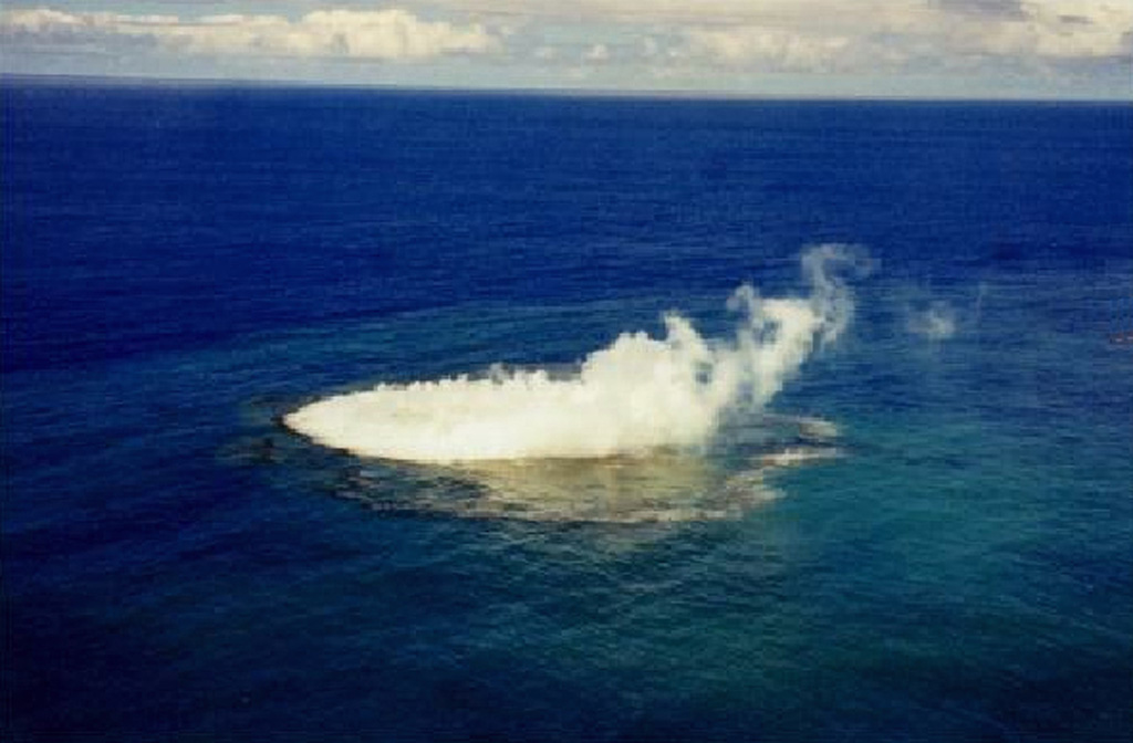
An unnamed submarine volcano is located along the Tofua Volcanic Arc 35 km NW of the Niu Aunofo lighthouse on Tongatapu Island. The first documented eruptions took place in 1911 and 1923; an ephemeral island was formed in 1999. A submarine eruption in January 2017 produced discolored water visible in satellite imagery.
Historial de erupciones
Resumen (VEI en el tiempo)
Haga clic en una barra para ver erupciones individuales
Línea de tiempo detallada
- 2017VEI 0Observado2017-01-23 – 2017-01-31Submarine
- 1999VEI 1Observado1999-01-08 – 1999-01-14
- 1970VEI 0Observado1970-01-03 – 1970-01-03
- 1923VEI 0Observado1923-07-01 – En curso
- 1911VEI 0Observado1911-08-16 – En curso
Enlaces externos
- Aún no mapeado en Wikidata.
- 🔗 Página original del Smithsonian GVP
⚠ Solo como referencia. No apto para respuesta ante emergencias.