Saltar al contenido principal

Fukue Volcano Group

Fukue

Campo volcánico · Japan · 315 m

The Ondake scoria cone rises to the NW above Shiozura Bay and is the highest of a group of small cones on the E side of Fukue Island, off the W coast of Kyushu. Activity at the Fukue volcano group began about 900,000 years ago and the latest activity took place about 2,000-3,000 years ago.
The Ondake scoria cone rises to the NW above Shiozura Bay and is the highest of a group of small cones on the E side of Fukue Island, off the W coast of Kyushu. Activity at the Fukue volcano group began about 900,000 years ago and the latest activity took place about 2,000-3,000 years ago. · Foto: Copyrighted photo by Tadahide Ui (Japanese Quaternary Volcanoes database, RIODB, http://riodb02.ibase.aist.go.jp/strata/VOL_JP/EN/index.htm and Geol Surv Japan, AIST, http://www.gsj.jp/).
Tipo
Campo volcánico
País
Japan
Región
Western Pacific Volcanic Regions / Nankai Volcanic Arc
Altitud
315 m
Coordenadas
32.657, 128.849
Última erupción
-400
Contexto tectónico
Subduction zone / Continental crust (> 25 km)
Forma volcánica
Cluster
Roca principal
Basalt / Picro-Basalt
Resumen geológico

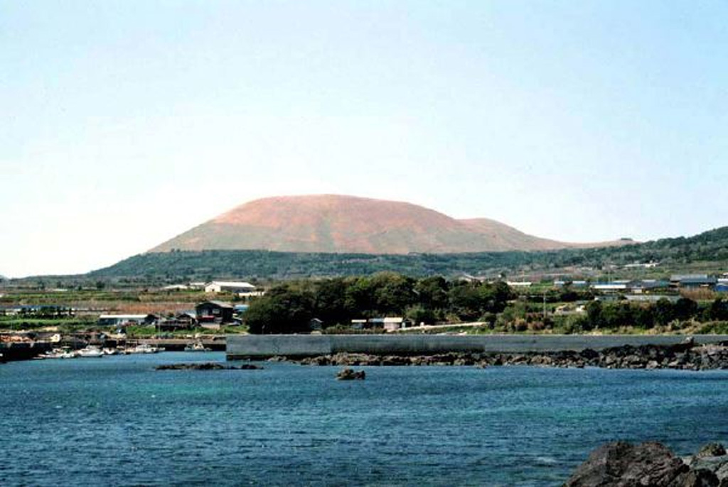
A group of small olivine basaltic shield volcanoes and cinder cones lies at the eastern end of Fukuejima in the Goto Islands off the western coast of Kyushu. Activity at the Fukue volcano group began about 900,000 years ago, and the latest activity took place about 2,000-3,000 years ago (Nakano et al., 2001-). The volcanic field, whose high point is the Onidake cinder cone (about 300 m elevation), forms peninsulas at the E and SE tips of Fukue Island as well as several smaller islands to the SE.

Resumen de Wikipedia

Resumen en inglés

Fukue Island is the largest and southernmost of the Gotō Islands in Japan. It is part of the city of Gotō in Nagasaki Prefecture. Gotō-Fukue Airport is on this island. As of July 31, 2016, the population is 38,481.

Wikipedia · CC BY-SA · Leer artículo completo

Historial de erupciones

Resumen (VEI en el tiempo)
Haga clic en una barra para ver erupciones individuales
400 BCE~400 BCE · 1 erupciones · VEI máx. ?400 BCE400 BCE399 BCE399 BCE399 BCE

Línea de tiempo detallada

  1. 400 a. C.VEI ?Estimación geológica
    BCE 400 – En curso
    Hino-take

Enlaces externos

⚠ Solo como referencia. No apto para respuesta ante emergencias.