South Sarigan Seamount
Estratovolcán · United States · 184 m (submarino)
- Tipo
- Estratovolcán
- País
- United States
- Región
- Pacífico Noroccidental / Mariana Volcanic Arc
- Altitud
- 184 m (submarino)
- Coordenadas
- 16.580, 145.780
- Última erupción
- 2010
- Contexto tectónico
- Subduction zone / Crustal thickness unknown
- Forma volcánica
- Composite
- Roca principal
- No Data (checked)
Resumen geológico
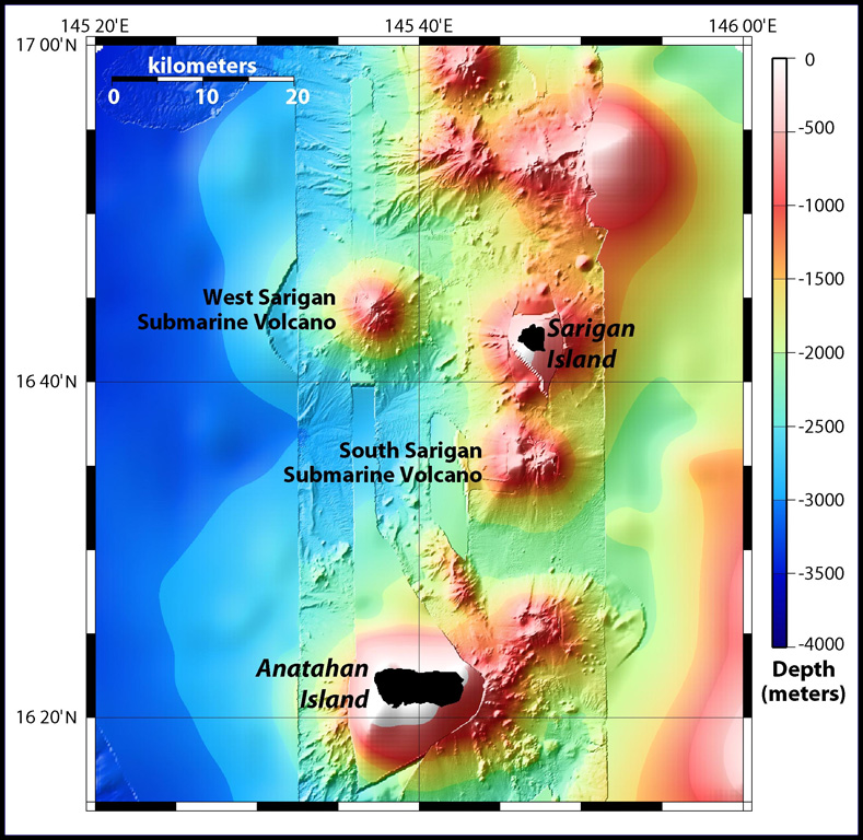
South Sarigan seamount, rising to within about 184 m of the ocean surface 12 km S of Sarigan Island, was the site of a short explosive submarine eruption in May 2010 that produced a plume of ash and steam to 12 km altitude. Sidescan sonar imagery taken in 2003 shows an irregular summit with multiple peaks, including a possibly young cone at about 350 m depth, and flank morphology suggests it is a frequently active volcano.
Historial de erupciones
Resumen (VEI en el tiempo)
Haga clic en una barra para ver erupciones individuales
Línea de tiempo detallada
- 2010VEI 3Observado2010-05-27 – 2010-05-29Northern summit cone, 184 m below sea level
Enlaces externos
- Todavía no está en Wikipedia (Español). Puede contribuir en Wikidata.
- 🔗 Página original del Smithsonian GVP
⚠ Solo como referencia. No apto para respuesta ante emergencias.