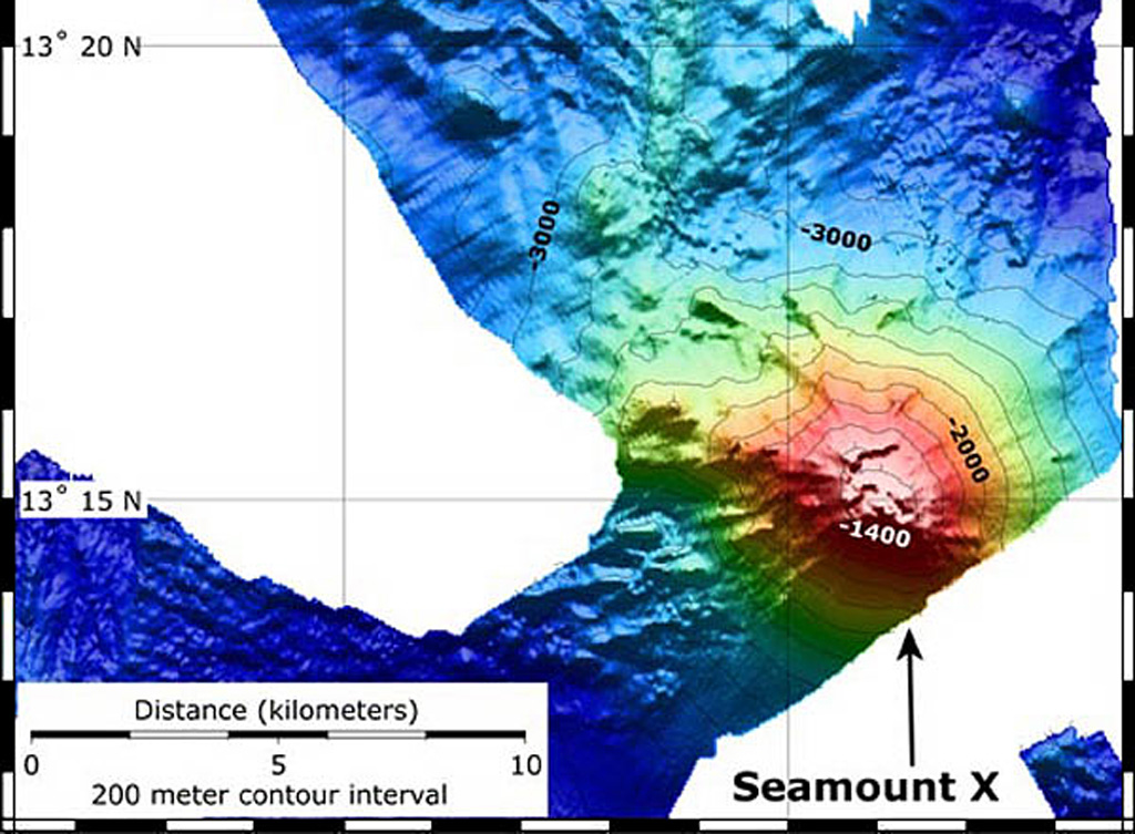
Seamount X
Estratovolcán · United States · 1230 m (submarino)
- Tipo
- Estratovolcán
- País
- United States
- Región
- Pacífico Noroccidental / Mariana Volcanic Arc
- Altitud
- 1230 m (submarino)
- Coordenadas
- 13.250, 144.020
- Última erupción
- Desconocido
- Contexto tectónico
- Subduction zone / Crustal thickness unknown
- Forma volcánica
- Composite
- Roca principal
- Basalt / Picro-Basalt
Resumen geológico
Hydrothermal activity was detected during a 2003 NOAA expedition at a submarine volcano about 70 km WSW of Guam. The summit of the volcano, referred to as Seamount X, lies 1,230 m below the ocean surface. Diffuse sites of thermal venting colonized by shrimps, crabs, and scaleworms were detected near the summit during a 2006 NOAA expedition, and thick deposits of sulfur flows originating from the hydrothermal vent were observed that were covered with thousands of squat lobsters. Basaltic rocks were recovered along with sulfur samples. The summit of the volcano is cut by an elongated caldera.
Historial de erupciones
Línea de tiempo detallada
No hay registros de erupciones disponibles.
Enlaces externos
- Todavía no está en Wikipedia (Español). Puede contribuir en Wikidata.
- 🔗 Página original del Smithsonian GVP
⚠ Solo como referencia. No apto para respuesta ante emergencias.