Kinenin
Maar · Russia · 583 m
- Tipo
- Maar
- País
- Russia
- Región
- Pacífico Noroccidental / Central Kamchatka Volcanic Arc
- Altitud
- 583 m
- Coordenadas
- 57.350, 160.970
- Última erupción
- 850
- Contexto tectónico
- Subduction zone / Continental crust (> 25 km)
- Forma volcánica
- Minor
- Roca principal
- Basalt / Picro-Basalt
Resumen geológico
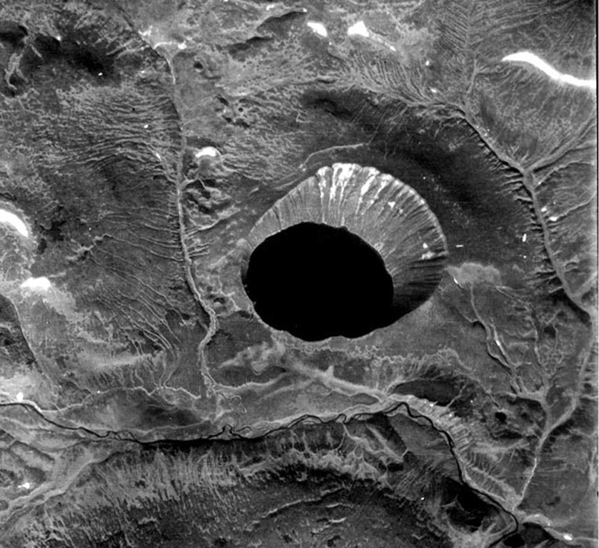
Kinenin maar lies at the eastern foot of the Sredinny Range, about 80 km NNW of Sheveluch volcano. The 2.5-km-wide, funnel-shaped maar was formed along the Kinenin River, a tributary of the Elovka. It is partially filled by a 1-km-wide lake whose surface is at 400 m elevation. The eastern rim at about 580 m is the high point of the crater. The eruption of Kinenin took place about 1,100 years ago, making it the youngest known maar in Kamchatka. Both silicic pyroclastic flows and mafic pyroclastic ejecta were produced, which were distributed primarily to the ENE. The location is north of the active Kamchatka subduction zone.
Historial de erupciones
Resumen (VEI en el tiempo)
Haga clic en una barra para ver erupciones individuales
Línea de tiempo detallada
- 850 (±50 años)VEI 4Estimación geológica850 – En curso
Enlaces externos
- Todavía no está en Wikipedia (Español). Puede contribuir en Wikidata.
- 🔗 Página original del Smithsonian GVP
⚠ Solo como referencia. No apto para respuesta ante emergencias.