Arshan
Arxan-Chaihe
Campo volcánico · China · 1677 m
- Tipo
- Campo volcánico
- País
- China
- Región
- Asia Oriental / Central East Asia Volcanic Province
- Altitud
- 1677 m
- Coordenadas
- 47.450, 120.800
- Última erupción
- 0
- Contexto tectónico
- Intraplate / Continental crust (> 25 km)
- Forma volcánica
- Cluster
- Roca principal
- Basalt / Picro-Basalt
Resumen geológico
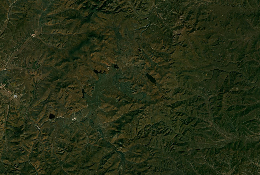
The Arxan-Chaihe Volcanic Field, in the central Da Hinggan Mountains of Inner Mongolia in NE China, contains at least 27 volcanic features. The youngest cones, including Yanshan and Gaoshan, produced basaltic lava flows that blocked drainages of the Halahale River and created six lava-dammed lakes. Radiocarbon dates from scoria deposits document eruptions about 2,000-1,900 years ago. The area has been designated as a National Geopark.
Historial de erupciones
Resumen (VEI en el tiempo)
Haga clic en una barra para ver erupciones individuales
Línea de tiempo detallada
- 0 (±150 años)VEI ?Estimación geológica0 – En curso
Enlaces externos
- Todavía no está en Wikipedia (Español). Puede contribuir en Wikidata.
- 🔗 Página original del Smithsonian GVP
⚠ Solo como referencia. No apto para respuesta ante emergencias.