Wudalianchi
Campo volcánico · China · 597 m
- Tipo
- Campo volcánico
- País
- China
- Región
- Asia Oriental / Central East Asia Volcanic Province
- Altitud
- 597 m
- Coordenadas
- 48.722, 126.150
- Última erupción
- 1776
- Contexto tectónico
- Intraplate / Continental crust (> 25 km)
- Forma volcánica
- Cluster
- Roca principal
- Trachybasalt / Tephrite Basanite
Resumen geológico
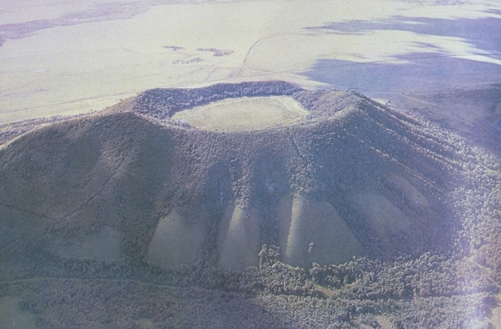
The Wudalianchi volcanic field, named for a string of five scenic lava-dammed lakes, consists of 14 cinder cones capping a 500 km2 shield-like lava plateau in NE China. The volcanic field, whose name means "Five Connected Pools" was formed during five eruptive cycles from the early Pleistocene to historical time. Its ancient name was "Nine Hills," which after the historical eruptions now number 14 hills. The cinder cones were erupted through basement sedimentary and granitic rocks and show a preferred alignment along three chains at the intersection of NE- and NW-trending lineaments. In addition to the historical cinder cones of Laoheishan and Huoshaoshan, Xilongmenshan and Donglongmenshan are Holocene in age. The freshly preserved cones of Laoheishan and Huoshaoshan were formed during eruptions in 1720-21. Fissures at the base of the two new cinder cones fed glassy pahoehoe and aa lava flows that covered 65 km2 and formed the five lakes of Wudalianchi at their eastern and northern margins. Renewed eruptions took place in 1776.
Historial de erupciones
Línea de tiempo detallada
- 1776VEI 2Observado1776 – En cursoLaoheishan
- 1720VEI 3Observado1720-01-14 – 1721-06Laoheishan and Huoshaoshan
Enlaces externos
- Todavía no está en Wikipedia (Español). Puede contribuir en Wikidata.
- 🔗 Página original del Smithsonian GVP
⚠ Solo como referencia. No apto para respuesta ante emergencias.