Red Hill volcanic field
Red Hill-Quemado
Campo volcánico · United States · 2300 m
- Tipo
- Campo volcánico
- País
- United States
- Región
- América del Norte / Basin and Range Volcanic Province
- Altitud
- 2300 m
- Coordenadas
- 34.250, -108.830
- Última erupción
- -9450
- Contexto tectónico
- Rift zone / Continental crust (> 25 km)
- Forma volcánica
- Cluster
- Roca principal
- Basalt / Picro-Basalt
Resumen geológico
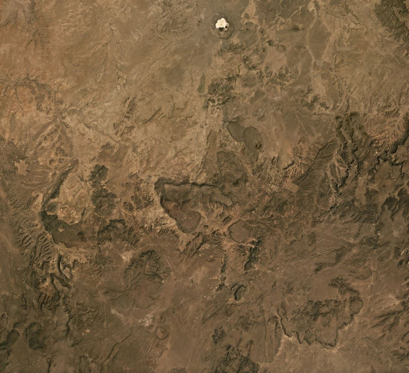
The Red Hill-Quemado volcanic field in western New Mexico is across the border from the Springerville volcanic field in Arizona and contains more than 40 cinder cones and maars that were active from the late Miocene to early Holocene. The volcanic field lies along the NE-trending Jemez Lineament that extends from SE Colorado to east-central Arizona. Dating by Onken and Forman (2017) showed that three eruptive events took place during the early Holocene, and that the 2-km-wide Zuni Salt Lake maar with its late-stage nested cinder cones was formed about 11,000-11,800 calibrated 14C years ago.
Resumen de Wikipedia
Resumen en inglésRed Hill volcanic field, also known as Quemado volcanic field, is a monogenetic volcanic field located in the vicinity of the ghost town of Red Hill in Catron County New Mexico. Red Hill is 24 kilometers (15 mi) east of the larger Springerville volcanic field and includes Zuñi Salt Lake. The area is made up of scoria cone and silicic dome fields. Over 40 volcanic vents have been identified in the field. These erupted basaltic flows, with no other rock types evident in the field.
Wikipedia · CC BY-SA · Leer artículo completo →
Historial de erupciones
Línea de tiempo detallada
- 9450 a. C. (±400 años)VEI ?Estimación geológicaBCE 9450 – En cursoZuni Salt Lake maar
- 9700 a. C. (±450 años)VEI ?Estimación geológicaBCE 9700 – En curso2.5 km radius of Zuni Salt Lake
- 9850 a. C. (±500 años)VEI ?Estimación geológicaBCE 9850 – En cursoCerro Pomo?
Enlaces externos
⚠ Solo como referencia. No apto para respuesta ante emergencias.