Southern EPR-Segment K
Southern EPR at 17.5°S (Segment K)
Fisura volcánica · Undersea Features · 2566 m (submarino)
- Tipo
- Fisura volcánica
- País
- Undersea Features
- Región
- Pacífico Sur / Southern East Pacific Rise Volcanic Province
- Altitud
- 2566 m (submarino)
- Coordenadas
- -17.436, -113.206
- Última erupción
- 1990
- Contexto tectónico
- Rift zone / Oceanic crust (< 15 km)
- Forma volcánica
- Cluster
- Roca principal
- Basalt / Picro-Basalt
Resumen geológico
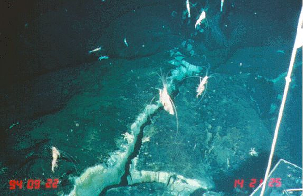
Lava flows from a very recent eruption were observed in 1994 along segment K of the southern East Pacific Rise. This segment of the mid-ocean ridge north of the Easter microplate displays the broadest cross-sectional area and the shallowest depth (2,566 m) of the southern East Pacific Rise between 13°40' and 18°30'S. Glassy, unsedimented lava flows on the 17.5°S segment of the East Pacific Rise were considered, from biological observations and chemical analyses of the plume and vent fluids, to have been erupted within 2-3 years of a November-December 1993 plume survey. Lava was erupted along two segments, a 4-km-long flow at the southern site and a 5-10 km flow at the northern site. Numerous low- and high-temperature hydrothermal vents are active along this segment of the ridge.
Historial de erupciones
Línea de tiempo detallada
- 1990 (±2 años)VEI 0Observado1990-07-02 – En curso
- 1965VEI 0Estimación geológica1965-07-02 – En cursoSouth of Aldo-Kihi lava flow
- 1930VEI 0Estimación geológica1930-07-02 – En cursoNorth of Aldo-Kiri lava flow
- 1840VEI 0Estimación geológica1840-07-02 – En cursoNorth of Aldo-Kiri lava flow
- 1625VEI 0Estimación geológica1625 – En cursoSouth of Aldo-Kihi lava flow
Enlaces externos
- Todavía no está en Wikipedia (Español). Puede contribuir en Wikidata.
- 🔗 Página original del Smithsonian GVP
⚠ Solo como referencia. No apto para respuesta ante emergencias.