Unnamed volcano
Central Andean Arc at 25.1°S
Cono piroclástico · Argentina · 4652 m
- Tipo
- Cono piroclástico
- País
- Argentina
- Región
- América del Sur / Central Andean Volcanic Arc
- Altitud
- 4652 m
- Coordenadas
- -25.078, -68.266
- Última erupción
- Desconocido
- Contexto tectónico
- Subduction zone / Continental crust (> 25 km)
- Forma volcánica
- Minor
- Roca principal
- Andesite / Basaltic Andesite
Resumen geológico
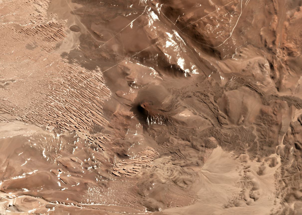
An isolated basaltic andesite cinder cone was constructed on top of Miocene ignimbrites and lava flows between the Corrida de Cori range on the Chile/Argentina border and the Salar Río Grande in Argentina. Blocky lava flows from the cone descended in a broad lobe to the SE and in a narrow tongue to the E nearly to the Salar Río Grande. A second smaller vent lies about 800 m NW of the cinder cone. The relatively fluid lava flows display surficial breadcrust textures and were considered by Richards and Villeneuve (2002) to be very young, possibly of Holocene age.
Historial de erupciones
Línea de tiempo detallada
No hay registros de erupciones disponibles.
Enlaces externos
- Todavía no está en Wikipedia (Español). Puede contribuir en Wikidata.
- 🔗 Página original del Smithsonian GVP
⚠ Solo como referencia. No apto para respuesta ante emergencias.