Crater Basalt Volcanic Field
Campo volcánico · Argentina · 1344 m
- Tipo
- Campo volcánico
- País
- Argentina
- Región
- América del Sur / Southern Andean Volcanic Arc
- Altitud
- 1344 m
- Coordenadas
- -42.018, -70.194
- Última erupción
- Desconocido
- Contexto tectónico
- Intraplate / Continental crust (> 25 km)
- Forma volcánica
- Cluster
- Roca principal
- Trachybasalt / Tephrite Basanite
Resumen geológico
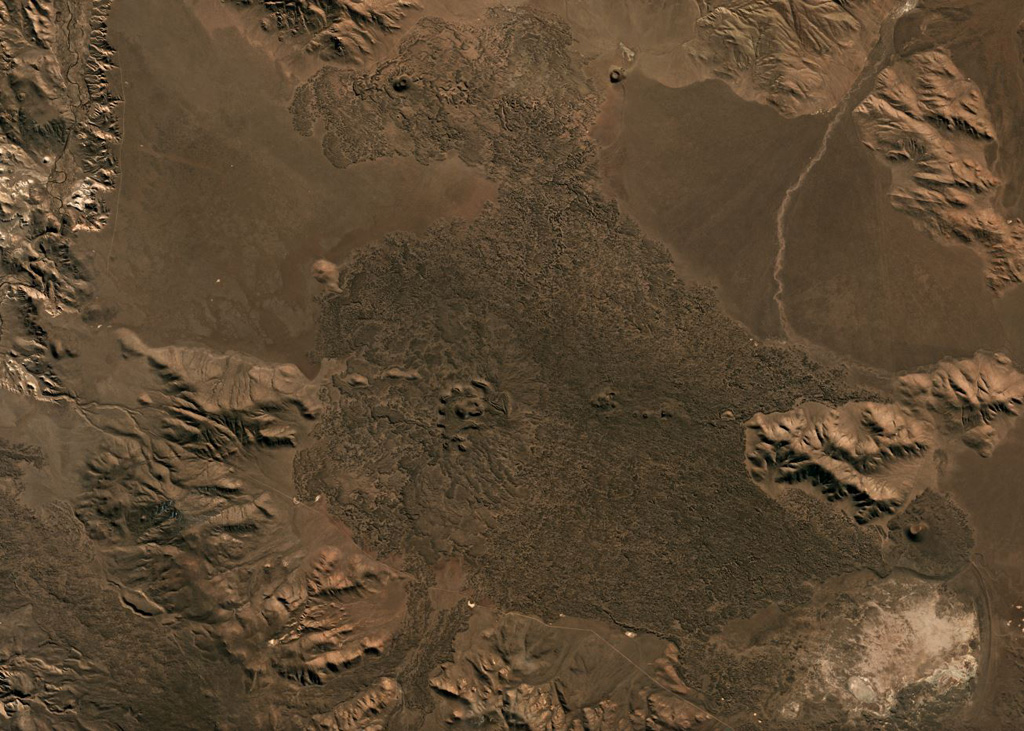
The Crater Basalt volcanic field in the northern Patagonia region of Argentina covers an area of about 700 km2. The field lies about 400 km E of the Peru-Chile trench along the broad regional Gastre fault system. Nine cinder cones and spatter cones produced blocky lava flows of alkali basaltic, basanitic, and trachybasaltic composition. One of the largest features is Cerro Fermín, a cinder cone that produced multiple lava flows. The highest cone, Cerro Negro, fed lava flows that traveled to the W, E, and then NE, where its distal margin is cut by a provincial road. Some of the lava flows, such as those from Cerro Ventana and Cerro Contreras, cover Holocene shorelines of playa lakes.
Historial de erupciones
Línea de tiempo detallada
No hay registros de erupciones disponibles.
Enlaces externos
- Todavía no está en Wikipedia (Español). Puede contribuir en Wikidata.
- 🔗 Página original del Smithsonian GVP
⚠ Solo como referencia. No apto para respuesta ante emergencias.