Brennisteinsfjöll
Brennisteinsfjoll
Fila de cráteres · Iceland · 610 m
- Tipo
- Fila de cráteres
- País
- Iceland
- Región
- Océano Atlántico / Iceland Neovolcanic Rift Volcanic Province
- Altitud
- 610 m
- Coordenadas
- 63.933, -21.783
- Última erupción
- 1341
- Contexto tectónico
- Rift zone / Oceanic crust (< 15 km)
- Forma volcánica
- Cluster
- Roca principal
- Basalt / Picro-Basalt
Resumen geológico
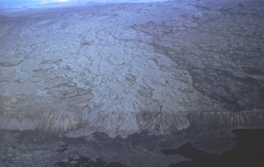
The Brennisteinsfjöll volcanic system, located east of Kleifarvatn lake, consists of a series of NE-SW-trending crater rows and small shield volcanoes. Postglacial and historical basaltic lavas cover a wide area. An eruption in 1000 CE was dated by its occurrence at the time of a meeting of the Icelandic outdoor parliament at Thingvellier. The most recent eruption took place in the 14th century.
Resumen de Wikipedia
Brennisteinsfjöll es una pequeña cadena montañosa con hileras de cráteres y pequeños volcanes en escudo en la península Reykjanes en el occidente de Islandia, a unos 26 km de la capital, Reikiavik.
Wikipedia · CC BY-SA · Leer artículo completo →
Historial de erupciones
Línea de tiempo detallada
- 1341 (±1 años)VEI 2Observado1341 – En cursoGrafeldur (Selvogshraun)
- 1200VEI 2Estimación geológica1200 – En cursoKongsfell
- 1000VEI 0Observado1000-06-25 – En cursoEldborg at Lambafell
- 950VEI 2Estimación geológica950 – En cursoRjupnadyngjur
- 910 (±75 años)VEI 2Estimación geológica910 – En cursoKista (Breiddalshraun)
- 875 (±50 años)VEI 2Estimación geológica875 – En cursoTvibollar
- 1040 a. C. (±75 años)VEI 2Estimación geológicaBCE 1040 – En cursoEldborg at Brennisteinsfjöllum
- 2660 a. C. (±75 años)VEI 0Estimación geológicaBCE 2660 – En cursoLeitin
- 9000 a. C.VEI 0Estimación geológicaBCE 9000 – En cursoHeidin Há
Enlaces externos
⚠ Solo como referencia. No apto para respuesta ante emergencias.