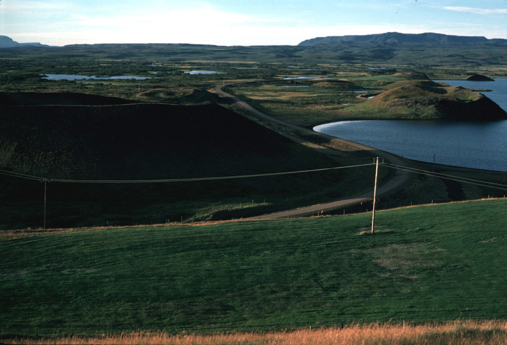
Heidarspordar
Fisura volcánica · Iceland · 490 m
- Tipo
- Fisura volcánica
- País
- Iceland
- Región
- Océano Atlántico / Iceland Neovolcanic Rift Volcanic Province
- Altitud
- 490 m
- Coordenadas
- 65.583, -16.817
- Última erupción
- -300
- Contexto tectónico
- Rift zone / Oceanic crust (< 15 km)
- Forma volcánica
- Cluster
Resumen geológico
The Heiðarsporðar volcanic system in the Northern Volcanic Zone is about 22 km long, consisting of a fissure swarm and a central volcano. It is embryonic, starting to develop in the marginal area of two adjacent fissure areas, Krafla and Fremrinámar, producing large-volume eruptions. No geothermal activity is present. Magma composition ranges from olivine-tholeiite through tholeiitic basalt and basaltic andesite to dacite. Characteristic activity consists of effusive basaltic eruptions and small predominantly effusive silicic eruptions. It has shown rather low activity in the Holocene but has produced substantial basaltic lava flows. Two eruptive periods have occurred in Holocene time separated by over 8,000 years. The last eruption took place about 2,200 years ago, producing a lava flow covering about 220 km2 and extending 60 km from source.
Resumen de Wikipedia
Resumen en inglésThe Heiðarsporðar volcanic system is located in northeast Iceland near Lake Mývatn. It is the source of numerous formations present in and around the lake, particularly in the form of pseudocraters.
Wikipedia · CC BY-SA · Leer artículo completo →
Historial de erupciones
Línea de tiempo detallada
- 300 a. C.VEI 2Estimación geológicaBCE 300 – En cursoThrengslaborgir-Ludentsborgir crater row
- 4050 a. C.VEI 0Estimación geológicaBCE 4050 – En cursoLudent crater rows
- 5750 a. C.VEI 0Estimación geológicaBCE 5750 – En cursoFjarborg
- 6150 a. C.VEI 0Estimación geológicaBCE 6150 – En cursoDrangagrundahraun
- 6950 a. C.VEI 0Estimación geológicaBCE 6950 – En cursoHraunbunga
- 7400 a. C. (±300 años)VEI 0Estimación geológicaBCE 7400 – En cursoHeidarspordur
- 7850 a. C.VEI ?Estimación geológicaBCE 7850 – En cursoLudent, Namafjall-Krofluhals
Enlaces externos
⚠ Solo como referencia. No apto para respuesta ante emergencias.