Mat Ala
Gunung api perisai · Ethiopia · 493 m
- Tipe
- Gunung api perisai
- Negara
- Ethiopia
- Wilayah
- Afrika Timur / Afar Rift Volcanic Province
- Ketinggian
- 493 m
- Koordinat
- 13.106, 41.161
- Letusan terakhir
- Tidak diketahui
- Kondisi tektonik
- Rift zone / Intermediate crust (15-25 km)
- Bentuk lahan
- Shield
- Batuan utama
- Basalt / Picro-Basalt
Ringkasan geologi
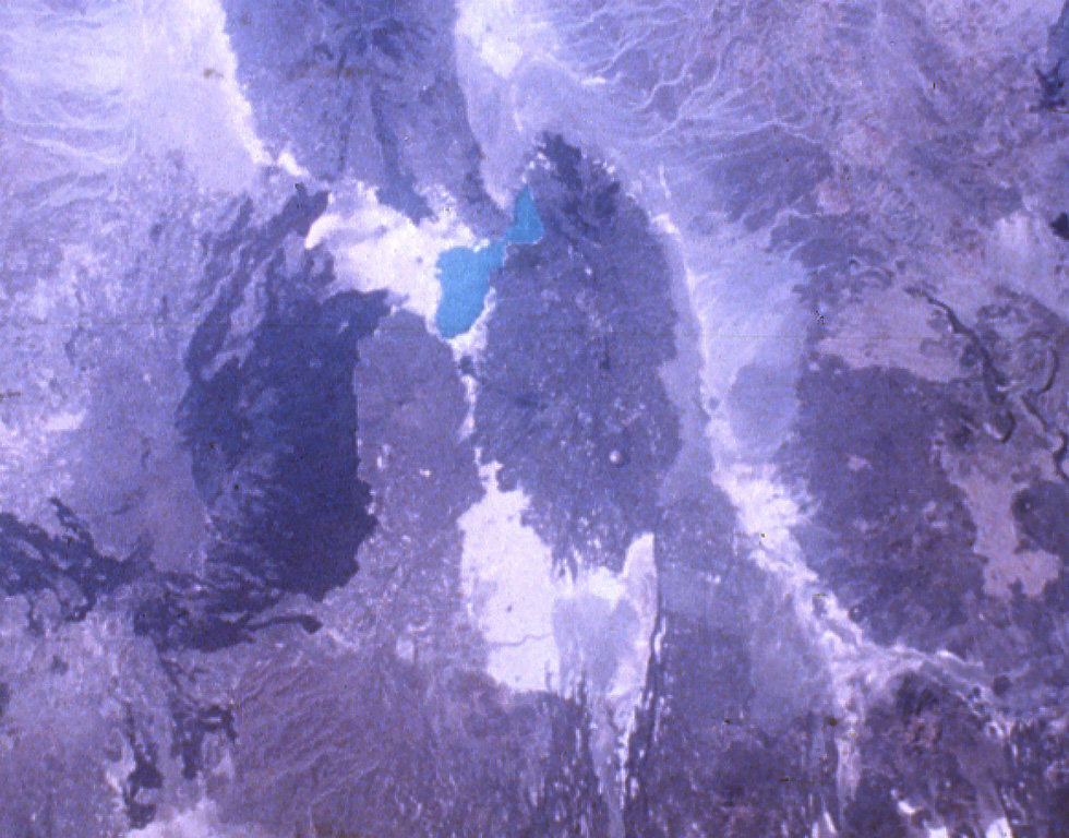
Mat Ala is a low shield volcano in the southern Tat Ali Range, east of Afderà volcano. A 300-m-deep, 2.5 x 3.5 km wide caldera is found at the summit of the volcano, whose flanks are cut by numerous N-S-trending faults. Mat Ala has been active during the Holocene, and fumarolic activity occurs along a fissure SW of the volcano.
Riwayat letusan
Garis waktu rinci
Tidak ada catatan letusan.
Tautan eksternal
- Belum ada di Wikipedia (Bahasa Indonesia). Anda dapat berkontribusi di Wikidata.
- 🔗 Halaman asli Smithsonian GVP
⚠ Untuk referensi saja. Bukan untuk tanggap darurat.