Groppo
Medan gunung api · Ethiopia · 852 m
- Tipe
- Medan gunung api
- Negara
- Ethiopia
- Wilayah
- Afrika Timur / Afar Rift Volcanic Province
- Ketinggian
- 852 m
- Koordinat
- 11.816, 40.242
- Letusan terakhir
- Tidak diketahui
- Kondisi tektonik
- Rift zone / Intermediate crust (15-25 km)
- Bentuk lahan
- Cluster
Ringkasan geologi
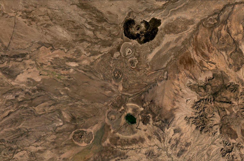
Groppo was identified by IAVCEI (1973) as a small alkali rhyolitic stratovolcano located in the western Afar near the Ethiopian escarpment, NE of Dessye. However, the nearest volcanic feature, identified in satellite imagery about 15 km NW from the given location, is a dark lava-flow field about 2.5 x 4.5 km in size, surrounding two small cones; two other smaller breached cones are nearby. The largest cone is about 300 x 500 m long, and 45 m high.
Riwayat letusan
Garis waktu rinci
Tidak ada catatan letusan.
Tautan eksternal
- Belum ada di Wikipedia (Bahasa Indonesia). Anda dapat berkontribusi di Wikidata.
- 🔗 Halaman asli Smithsonian GVP
⚠ Untuk referensi saja. Bukan untuk tanggap darurat.