Tangaroa Seamount
Tangaroa
Stratovolkan · New Zealand · 600 m (bawah laut)
- Tipe
- Stratovolkan
- Negara
- New Zealand
- Wilayah
- Tonga & Kermadec / Southern Kermadec Volcanic Arc
- Ketinggian
- 600 m (bawah laut)
- Koordinat
- -36.321, 178.028
- Letusan terakhir
- Tidak diketahui
- Kondisi tektonik
- Subduction zone / Oceanic crust (< 15 km)
- Bentuk lahan
- Composite
- Batuan utama
- Basalt / Picro-Basalt
Ringkasan geologi
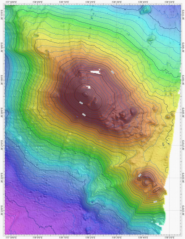
Tangaroa submarine volcano in the southern Kermadec arc rises to within 600 m of the ocean surface. The volcano is elongated in a NW-SE direction and contains smaller cones on its SE to eastern flanks. A larger edifice lies further to the SE. Tangaroa lies between Clark and Rumble V submarine volcanoes near the southern end of the Kermadec arc and is one of more than a half dozen volcanoes in this part of the arc showing evidence for active hydrothermal vent fields.
Riwayat letusan
Garis waktu rinci
Tidak ada catatan letusan.
Tautan eksternal
- Belum ada di Wikipedia (Bahasa Indonesia). Anda dapat berkontribusi di Wikidata.
- 🔗 Halaman asli Smithsonian GVP
⚠ Untuk referensi saja. Bukan untuk tanggap darurat.