Rumble V Seamount
Rumble V
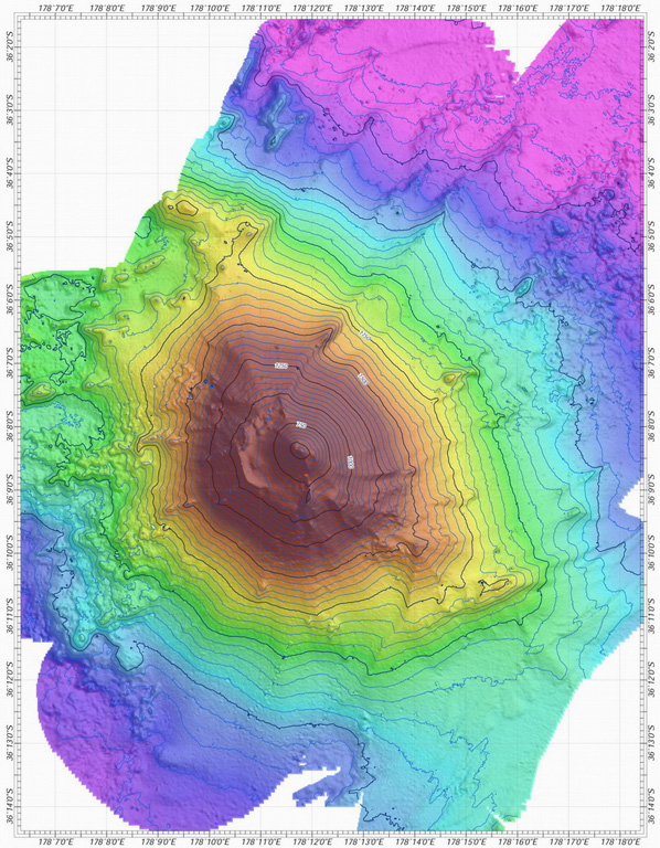
Stratovolkan · New Zealand · 400 m (bawah laut)
- Tipe
- Stratovolkan
- Negara
- New Zealand
- Wilayah
- Tonga & Kermadec / Southern Kermadec Volcanic Arc
- Ketinggian
- 400 m (bawah laut)
- Koordinat
- -36.142, 178.196
- Letusan terakhir
- Tidak diketahui
- Kondisi tektonik
- Subduction zone / Oceanic crust (< 15 km)
- Bentuk lahan
- Composite
- Batuan utama
- Andesite / Basaltic Andesite
Ringkasan geologi
Rumble V was discovered in 1992 at the southernmost end of the Rumble seamounts on the southern Kermadec Ridge, 17 km ESE of Rumble IV. Andesitic and basaltic andesite rocks have been dredged from this volcano, which rises more than 2,000 m to nearly 400 m below the ocean surface and shows a pristine morphology. A large plume of gas bubbles was acoustically detected rising from the summit in 1992, and subsequent expeditions detected evidence of vigorous hydrothermal activity.
Riwayat letusan
Garis waktu rinci
Tidak ada catatan letusan.
Tautan eksternal
- Belum ada di Wikipedia (Bahasa Indonesia). Anda dapat berkontribusi di Wikidata.
- 🔗 Halaman asli Smithsonian GVP
⚠ Untuk referensi saja. Bukan untuk tanggap darurat.