Rumble II West Seamount
Rumble II West
Stratovolkan · New Zealand · 1200 m (bawah laut)
- Tipe
- Stratovolkan
- Negara
- New Zealand
- Wilayah
- Tonga & Kermadec / Southern Kermadec Volcanic Arc
- Ketinggian
- 1200 m (bawah laut)
- Koordinat
- -35.353, 178.527
- Letusan terakhir
- Tidak diketahui
- Kondisi tektonik
- Subduction zone / Oceanic crust (< 15 km)
- Bentuk lahan
- Composite
- Batuan utama
- Andesite / Basaltic Andesite
Ringkasan geologi
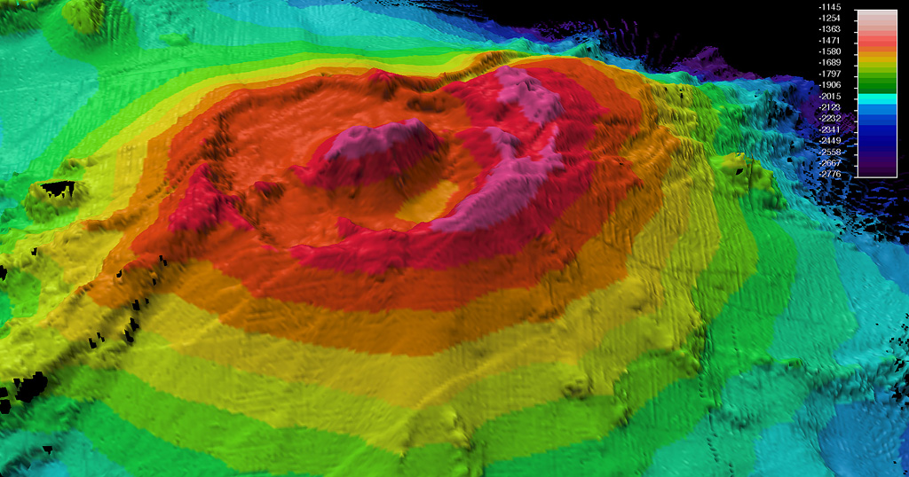
Rumble II West, about 12 km NW of Rumble II East, rises 1,800 m from the ocean floor to within 1,200 m of the surface. Bathymetry shows a 2.5-3 km summit caldera about 200 m deep with a central cone. There is evidence of hydrothermal activity, and cones are present on the flanks. Some lava flows on the western flanks originating from near the caldera rim have little or no sediment cover.
Riwayat letusan
Garis waktu rinci
Tidak ada catatan letusan.
Tautan eksternal
- Belum ada di Wikipedia (Bahasa Indonesia). Anda dapat berkontribusi di Wikidata.
- 🔗 Halaman asli Smithsonian GVP
⚠ Untuk referensi saja. Bukan untuk tanggap darurat.