Tofua Arc at 20.9°S
Stratovolkan · Tonga · 296 m (bawah laut)
- Tipe
- Stratovolkan
- Negara
- Tonga
- Wilayah
- Tonga & Kermadec / Tofua Volcanic Arc
- Ketinggian
- 296 m (bawah laut)
- Koordinat
- -20.852, -175.550
- Letusan terakhir
- 2017
- Kondisi tektonik
- Subduction zone / Oceanic crust (< 15 km)
- Bentuk lahan
- Composite
- Batuan utama
- No Data (checked)
Ringkasan geologi
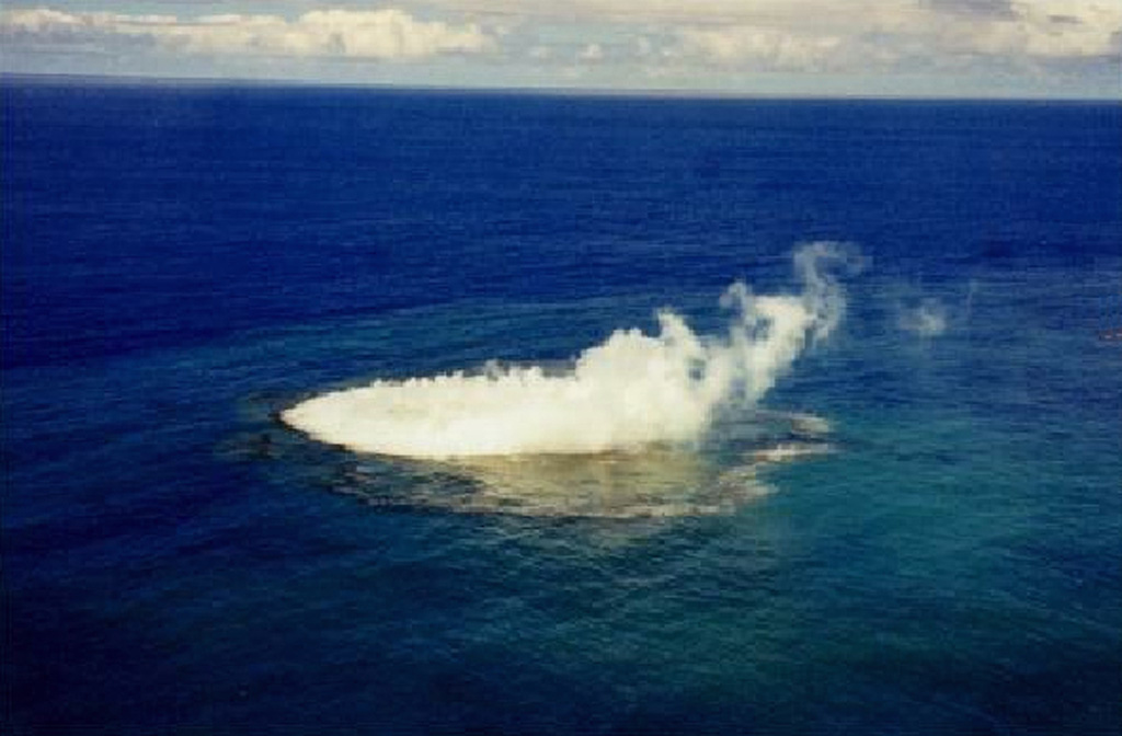
An unnamed submarine volcano is located along the Tofua Volcanic Arc 35 km NW of the Niu Aunofo lighthouse on Tongatapu Island. The first documented eruptions took place in 1911 and 1923; an ephemeral island was formed in 1999. A submarine eruption in January 2017 produced discolored water visible in satellite imagery.
Riwayat letusan
Ringkasan (VEI dari waktu ke waktu)
Klik pada bar untuk melihat letusan individu
Garis waktu rinci
- 2017VEI 0Teramati2017-01-23 – 2017-01-31Submarine
- 1999VEI 1Teramati1999-01-08 – 1999-01-14
- 1970VEI 0Teramati1970-01-03 – 1970-01-03
- 1923VEI 0Teramati1923-07-01 – Berlangsung
- 1911VEI 0Teramati1911-08-16 – Berlangsung
Tautan eksternal
- Belum dipetakan di Wikidata.
- 🔗 Halaman asli Smithsonian GVP
⚠ Untuk referensi saja. Bukan untuk tanggap darurat.