Gunung Patuha
Patuha
Stratovolkan · Indonesia · 2422 m
- Tipe
- Stratovolkan
- Negara
- Indonesia
- Wilayah
- Sunda & Banda / Sunda Volcanic Arc
- Ketinggian
- 2422 m
- Koordinat
- -7.162, 107.400
- Letusan terakhir
- Tidak diketahui
- Kondisi tektonik
- Subduction zone / Continental crust (> 25 km)
- Bentuk lahan
- Composite
- Batuan utama
- Andesite / Basaltic Andesite
Ringkasan geologi
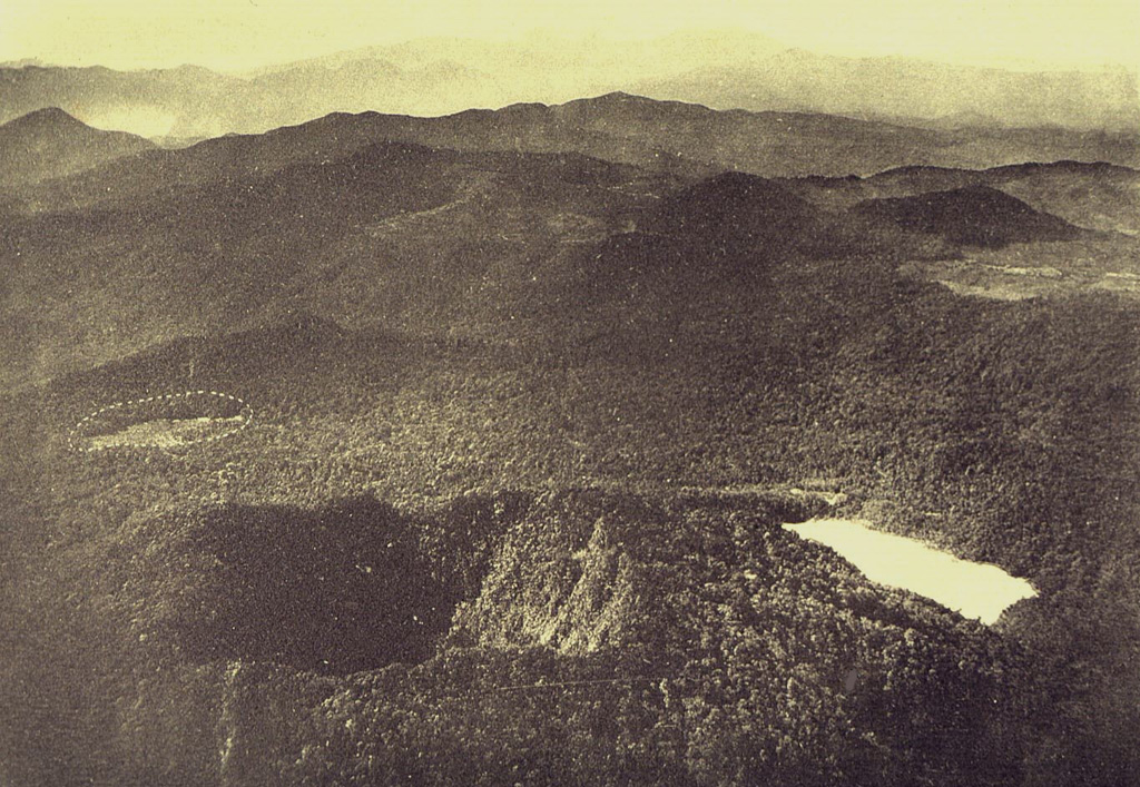
The forested andesitic Gunung Patuha rises SW of the plain of Bandung in western Java. Patuha is the northern peak of a roughly 5-km-long N-S volcanic massif, and has a 300 m crater at the summit. A few hundred meters down the SE flank is a 400 x 500 m crater almost completely filled with a shallow greenish lake, Kawah Putih. Sulfur deposits are present around the shoreline and near active fumaroles on the crater walls. A large debris-avalanche deposit extends down the NE flank. The volcano was formed during the late Pleistocene, but no Holocene eruptions are known.
Riwayat letusan
Garis waktu rinci
Tidak ada catatan letusan.
Tautan eksternal
⚠ Untuk referensi saja. Bukan untuk tanggap darurat.