Gunung Hiri
Hiri
Stratovolkan · Indonesia · 687 m
- Tipe
- Stratovolkan
- Negara
- Indonesia
- Wilayah
- Pasifik Barat / Halmahera Volcanic Arc
- Ketinggian
- 687 m
- Koordinat
- 0.897, 127.317
- Letusan terakhir
- Tidak diketahui
- Kondisi tektonik
- Subduction zone / Oceanic crust (< 15 km)
- Bentuk lahan
- Composite
- Batuan utama
- Basalt / Picro-Basalt
Ringkasan geologi
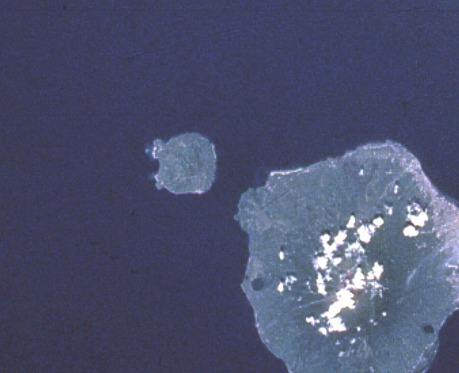
Hiri is a 3-km-wide forested island immediately north of Gamalama on Ternate Island, and is the northernmost of a chain of volcanic islands off the western coast of Halmahera. Two conical volcanic edifices are present within a larger caldera open to the W. Apandi and Sudana (1980) mapped it as Holocene in age, but no eruptions have been dated or reported.
Ringkasan Wikipedia
Gunung Hiri adalah pulau hutan dengan lebar 3 km yang terletak di utara Pulau Ternate, Provinsi Maluku Utara. Gunung Hiri terletak di ujung utara dari rantai kepulauan vulkanik yang berada di pesisir barat Pulau Halmahera. Gunung ini merupakan kerucut vulkanik dengan tinggi 630 m yang terletak di selatan dari Gunung Gamalama.
Wikipedia · CC BY-SA · Baca artikel lengkap →
Riwayat letusan
Garis waktu rinci
Tidak ada catatan letusan.
Tautan eksternal
⚠ Untuk referensi saja. Bukan untuk tanggap darurat.