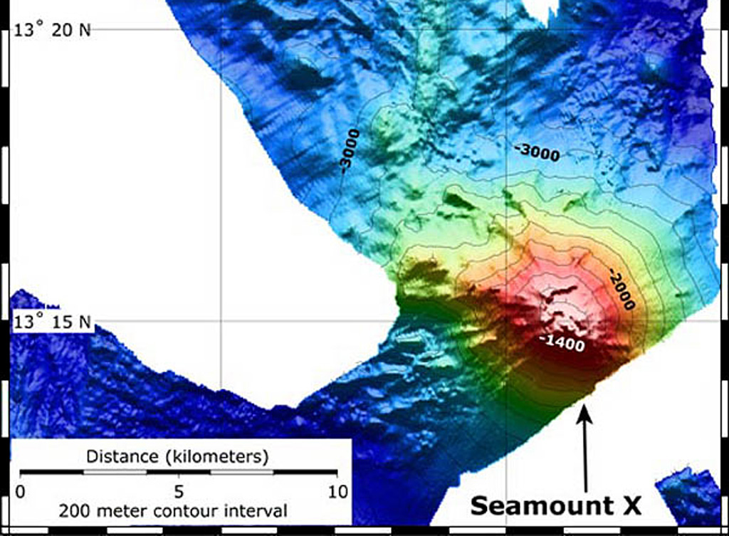
Seamount X
Stratovolkan · United States · 1230 m (bawah laut)
- Tipe
- Stratovolkan
- Negara
- United States
- Wilayah
- Pasifik Barat Laut / Mariana Volcanic Arc
- Ketinggian
- 1230 m (bawah laut)
- Koordinat
- 13.250, 144.020
- Letusan terakhir
- Tidak diketahui
- Kondisi tektonik
- Subduction zone / Crustal thickness unknown
- Bentuk lahan
- Composite
- Batuan utama
- Basalt / Picro-Basalt
Ringkasan geologi
Hydrothermal activity was detected during a 2003 NOAA expedition at a submarine volcano about 70 km WSW of Guam. The summit of the volcano, referred to as Seamount X, lies 1,230 m below the ocean surface. Diffuse sites of thermal venting colonized by shrimps, crabs, and scaleworms were detected near the summit during a 2006 NOAA expedition, and thick deposits of sulfur flows originating from the hydrothermal vent were observed that were covered with thousands of squat lobsters. Basaltic rocks were recovered along with sulfur samples. The summit of the volcano is cut by an elongated caldera.
Riwayat letusan
Garis waktu rinci
Tidak ada catatan letusan.
Tautan eksternal
- Belum ada di Wikipedia (Bahasa Indonesia). Anda dapat berkontribusi di Wikidata.
- 🔗 Halaman asli Smithsonian GVP
⚠ Untuk referensi saja. Bukan untuk tanggap darurat.