Tebenkova
Odamoisan [Tebenkov]
Stratovolkan · Japan - administered by Russia · 1208 m
- Tipe
- Stratovolkan
- Negara
- Japan - administered by Russia
- Wilayah
- Northwestern Pacific Volcanic Regions / Kuril Volcanic Arc
- Ketinggian
- 1208 m
- Koordinat
- 45.028, 147.918
- Letusan terakhir
- Tidak diketahui
- Kondisi tektonik
- Subduction zone / Intermediate crust (15-25 km)
- Bentuk lahan
- Composite
Ringkasan geologi
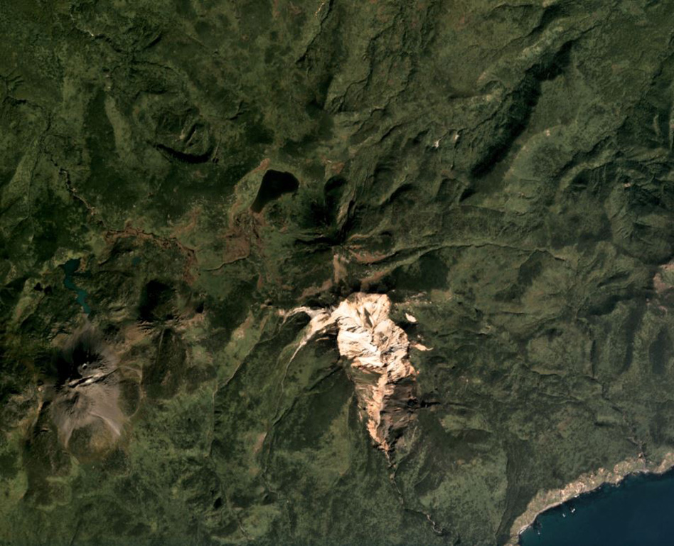
Odamoisan (also known as Tebenkov), lies in the center of Iturup Island along the E coast. This forested andesitic volcano lies immediately NE of the Etorofu-Yakeyama (Ivan Grozny) dome complex. The large Machekh crater, which displays strong fumarolic activity, lies immediately south. There have been no observed eruptions.
Riwayat letusan
Garis waktu rinci
Tidak ada catatan letusan.
Tautan eksternal
- Belum ada di Wikipedia (Bahasa Indonesia). Anda dapat berkontribusi di Wikidata.
- 🔗 Halaman asli Smithsonian GVP
⚠ Untuk referensi saja. Bukan untuk tanggap darurat.