Brennisteinsfjöll
Brennisteinsfjoll
Barisan kawah · Iceland · 610 m
- Tipe
- Barisan kawah
- Negara
- Iceland
- Wilayah
- Samudra Atlantik / Iceland Neovolcanic Rift Volcanic Province
- Ketinggian
- 610 m
- Koordinat
- 63.933, -21.783
- Letusan terakhir
- 1341
- Kondisi tektonik
- Rift zone / Oceanic crust (< 15 km)
- Bentuk lahan
- Cluster
- Batuan utama
- Basalt / Picro-Basalt
Ringkasan geologi
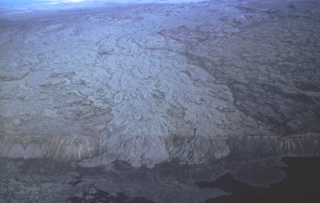
The Brennisteinsfjöll volcanic system, located east of Kleifarvatn lake, consists of a series of NE-SW-trending crater rows and small shield volcanoes. Postglacial and historical basaltic lavas cover a wide area. An eruption in 1000 CE was dated by its occurrence at the time of a meeting of the Icelandic outdoor parliament at Thingvellier. The most recent eruption took place in the 14th century.
Ringkasan Wikipedia
Ringkasan InggrisBrennisteinsfjöll is a minor volcanic system, with crater rows and small shield volcanoes on the Reykjanes Peninsula in southwest Iceland.
Wikipedia · CC BY-SA · Baca artikel lengkap →
Riwayat letusan
Ringkasan (VEI dari waktu ke waktu)
Klik pada bar untuk melihat letusan individu
Garis waktu rinci
- 1341 (±1 tahun)VEI 2Teramati1341 – BerlangsungGrafeldur (Selvogshraun)
- 1200VEI 2Perkiraan geologi1200 – BerlangsungKongsfell
- 1000VEI 0Teramati1000-06-25 – BerlangsungEldborg at Lambafell
- 950VEI 2Perkiraan geologi950 – BerlangsungRjupnadyngjur
- 910 (±75 tahun)VEI 2Perkiraan geologi910 – BerlangsungKista (Breiddalshraun)
- 875 (±50 tahun)VEI 2Perkiraan geologi875 – BerlangsungTvibollar
- 1040 SM (±75 tahun)VEI 2Perkiraan geologiBCE 1040 – BerlangsungEldborg at Brennisteinsfjöllum
- 2660 SM (±75 tahun)VEI 0Perkiraan geologiBCE 2660 – BerlangsungLeitin
- 9000 SMVEI 0Perkiraan geologiBCE 9000 – BerlangsungHeidin Há
Tautan eksternal
⚠ Untuk referensi saja. Bukan untuk tanggap darurat.