Hayli Gubbi
Vulcano a scudo · Ethiopia · 493 m
- Tipo
- Vulcano a scudo
- Paese
- Ethiopia
- Regione
- Africa orientale / Afar Rift Volcanic Province
- Altitudine
- 493 m
- Coordinate
- 13.511, 40.716
- Ultima eruzione
- 2025
- Contesto tettonico
- Rift zone / Intermediate crust (15-25 km)
- Forma vulcanica
- Shield
- Roccia principale
- Basalt / Picro-Basalt
Sintesi geologica
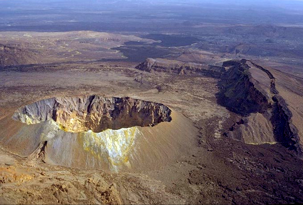
Hayli Gubbi is the southernmost volcano of the Erta Ale Range. Recent tectonism has created a NW-SE graben across the summit, with a 380-m-diameter scoria cone at the summit and a 260-m-diameter crater displaying fumarolic activity. A sequence of fissure vents and lava fields extends 6 km NW to the southern caldera of Erta Ale. Additional dark flows that originated from the summit area cover the W and NE flanks, and SE before turning E at the base on the shield. More fissure vents extend ~3.5 km SSE within the graben to another small shield. From there, the line of vents continues, along with a lava field that spreads across the Afrera Plain, to a distance of 25 km from the summit crater. Barberi and Varet (1970) reported that those basaltic flow fronts covered sediments in the plain which Roubet et al. (1969) described as lacustrine limestones and diatomites deposited around 8,200 years BP above hyaloclastite formations. This places the eruption of the SE-most flows sometime within the last 8,000 years, but no additional information about how recent they might be is known; in appearance they are similar to very recent flows from the Erta Ale shield. On 15 July 2025 a dike intrusion that originated at the Erta Ale N caldera pit craters produced active fissure vents and lava flows within and on the S flanks of the south caldera; another set of fissure vents were active 4 km SE from the caldera rim, within 2 km of the Hayli Gubbi crater. A large explosive eruption on 23 November 2025 excavated the previous summit cone and created a second large crater (~200 m in diameter) in the summit area, and a third smaller crater.
Sintesi da Wikipedia
Riassunto in ingleseHayli Gubbi is a shield volcano located in the Afar Region of Ethiopia. It is the southernmost volcano of the Erta Ale Range. Until November 2025, there was no direct record of any eruptions of this volcano, although records of eruptions in the area are limited by the remoteness of the region. However, studies in 1969 and 1970 identified lava flows on Hayli Gubbi's southern flank that overflowed rock formations which had formed around 8200 years Before Present (BP), showing the volcano must have erupted some time more recently than 8250 years ago prior to 2025.
Wikipedia · CC BY-SA · Leggi l'articolo completo →
Storia delle eruzioni
Cronologia dettagliata
- 2025VEI ?Osservata2025-11-23 – 2025-11-23
- 6250 a.C.VEI ?Stima geologicaBCE 6250 – In corsoS flank
Link esterni
⚠ Solo a scopo informativo. Non adatto a situazioni di emergenza.