Groppo
Campo vulcanico · Ethiopia · 852 m
- Tipo
- Campo vulcanico
- Paese
- Ethiopia
- Regione
- Africa orientale / Afar Rift Volcanic Province
- Altitudine
- 852 m
- Coordinate
- 11.816, 40.242
- Ultima eruzione
- Sconosciuto
- Contesto tettonico
- Rift zone / Intermediate crust (15-25 km)
- Forma vulcanica
- Cluster
Sintesi geologica
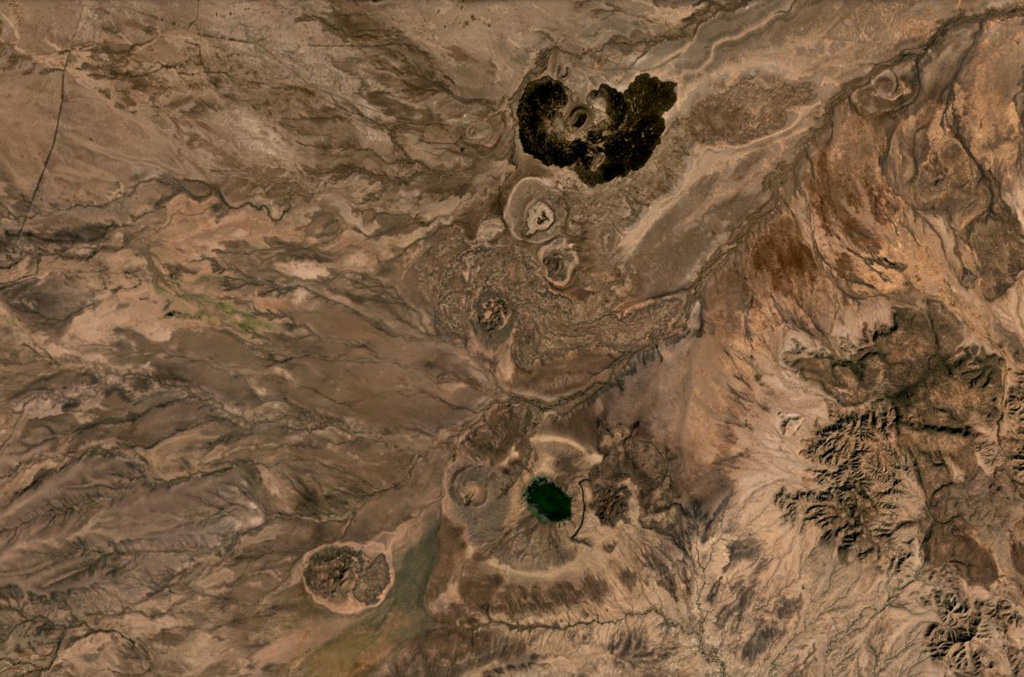
Groppo was identified by IAVCEI (1973) as a small alkali rhyolitic stratovolcano located in the western Afar near the Ethiopian escarpment, NE of Dessye. However, the nearest volcanic feature, identified in satellite imagery about 15 km NW from the given location, is a dark lava-flow field about 2.5 x 4.5 km in size, surrounding two small cones; two other smaller breached cones are nearby. The largest cone is about 300 x 500 m long, and 45 m high.
Storia delle eruzioni
Cronologia dettagliata
Nessuna registrazione di eruzioni disponibile.
Link esterni
- Non ancora su Wikipedia (Italiano). Puoi contribuire su Wikidata.
- 🔗 Pagina originale Smithsonian GVP
⚠ Solo a scopo informativo. Non adatto a situazioni di emergenza.